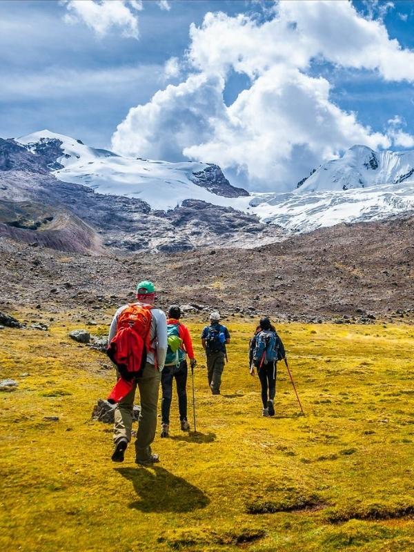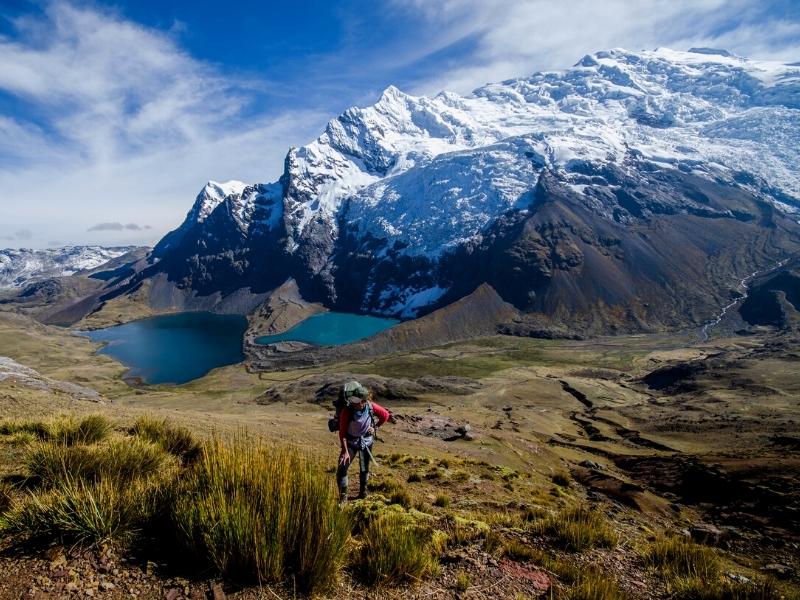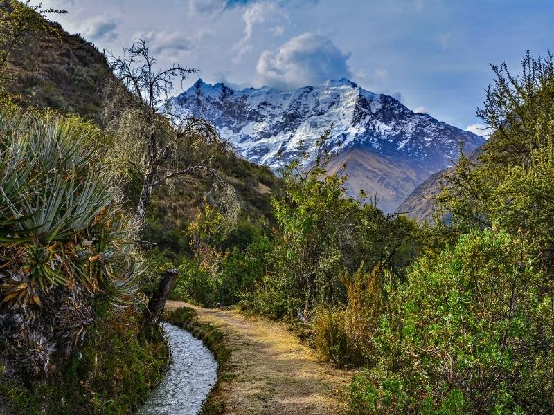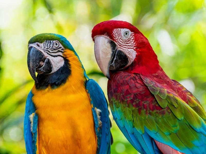
The Inca trail to Machu Picchu was built during the time of the Inca Pachakuteq in the 15th century. This work demonstrates the great advances in civil engineering by the Incas. Its construction was due to the great interest shown by the Incas to conquer the territories located in the great Amazon basin, since from there the Amazonian people brought the products most in demand by the Incas, we refer to the multicoloured feathers of macaws and parrots, the incense of palo santo, medicinal plants, the chonta palms that were used to manufacture weapons of war, due to their great hardness, arrows with poison tips were made with them.
The Amazon was also a great source of the sacred coca leaves, since they were in great demand for different work and feverish activities such as agriculture where men chewed kilos of coca leaves, it was said that the coca leaf was very nutritious and calmed hunger and thirst. It is believed that the Incas managed to consolidate alliances with the Amazonian settlers, since thanks to the construction of the Inca roads, starting from Cusco, it was easier to administer the most distant regions. In this context, the citadel of Machu Picchu was a strategic capital between the Andes and the Amazon plain; if we analyze the closest accesses to the Amazon, Machu Picchu is the one with the shortest distance.
The construction of the Inca trail to Machu Picchu was done with the abundant labor of the peoples subjugated by the Inca kings, these workers were brought from the distant territories of present-day Ecuador, northern Peru and northern Argentina. Thousands of workers and their families were displaced to the different work fronts, they built the terraces, roads, bridges, temples and residences of the Incas. When the construction projects were completed, they returned to their villages of origin, only a few stayed to take care of and maintain the royal residences of the Incas on the Inca Trail to Machu Picchu. Today we can still see many of these Inca buildings on the Inca Trail, which have been able to remain indestructible over the years and vegetation.
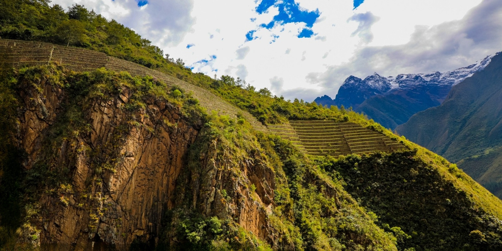
Along the Inca Trail or Qhapaq Ñan route that extends from Qoriwayrachina, at kilometer 88 of the Cuzco-Machu Picchu railway, there are various archaeological sites, including Wiñay Huayna and Intipata. All of great magnificence, they show the same basic characteristics as Machu Picchu, both in terms of the application of civil engineering and construction techniques. For this reason, the construction of all these sites, as well as the Inca Trail of this section, must also correspond to Inca times.
According to the hypothesis proposed here, these are administrative centers for food production, as well as places of worship and rituals fundamentally aimed at exorcising adverse climatic phenomena in order to achieve abundant harvests. Most of these sites were made known to the world by Hiram Bingham. Although he did not go beyond Sayacmarca, they were identified by the explorer during his journey along the aforementioned section of the Inca Trail.
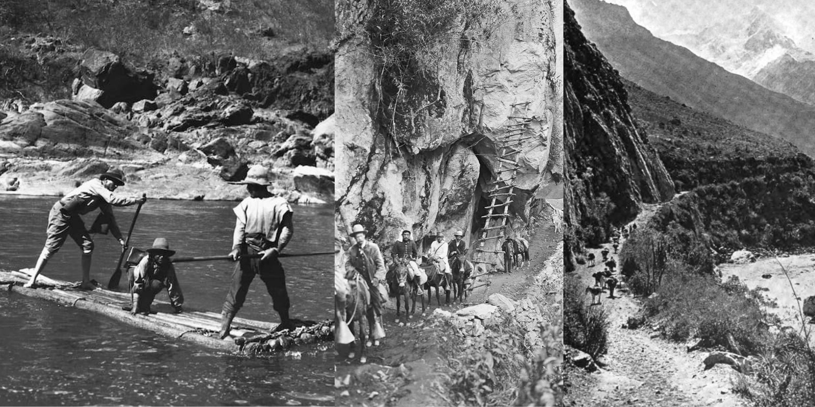
This took place within the framework of the second expedition that Bingham led to Machu Picchu in 1914-15, sponsored, like the first, by Yale University. The archaeological monuments along the Inca Trail were later studied systematically by The Wenner Green Scientific Expedition, led in 1941 by Paul Fejos; with the exception of Wiñay Wayna, which was investigated by Julio C. Tello and his team, in which the remembered archaeologist Manuel Chávez Ballón actively participated, among others.
Years later, in the 1970s and 1980s, the site of LLactapata or Patallacta was subjected to detailed investigations by Ann Kendall. During the clearing works carried out on the Inca Trail, new branches were located by Justo Torres and Percy Ardiles, which in turn allowed them to identify the archaeological site of Kantupata. In 1982, Wilfredo Yépez Valdés and Alfredo Valencia, while exploring other trails in the area of the Inca Trail in question, located the group of ruins they named Killapata. The Inca Trail that links Qoriwayrachina with Machu Picchu was travelled in 1986 by the prominent historian from Cuzco, Víctor Angles Vargas, who describes in detail the archaeological evidence present on the road. His observations are added to those made by Paul Fejos. Only after the aforementioned study trip undertaken by Angles Vargas was it realized that it was important to travel this section of the Inca Trail that links such prodigious monuments.
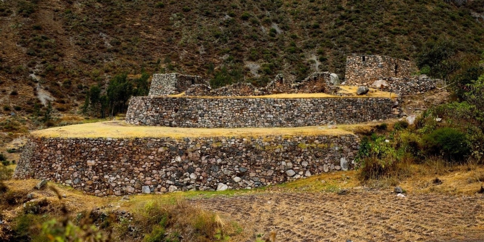
The Salapunku archaeological complex is located on the right bank of the Urubamba River, at an altitude of 2,625 meters above sea level. Likewise, the Salapunku monument “Limits to the north with the snowy Verónica (Waqaywillka), to the east with the town of Pisq’akucho, to the south with the Vilcanota River and to the west with the ruins of Qhanabamba. It corresponds to the Dry Forest – Low Montane Subtropical life zone. This monument is located approximately 1 km from the community of Piscacucho (km 82 of the Cusco-Hydroelectric railway line). Likewise, the monument has been divided into twelve (12) sectors. It is described that the pre-Hispanic architecture in these spaces had functions linked to defense, agricultural production and storage.
Salapunco is made up of numerous cultivation terraces built on a steep slope and finely carved walls, in which three doorways stand out. One of these leads via a staircase to an underground enclosure with niches and cylindrical stones embedded in the masonry. Salapunku had three moments or periods of occupation, with specific models of culturalization of the Killke, Qotaqalli and Chanapata settlements being found, manifested through architecture and in context with the pottery styles found.
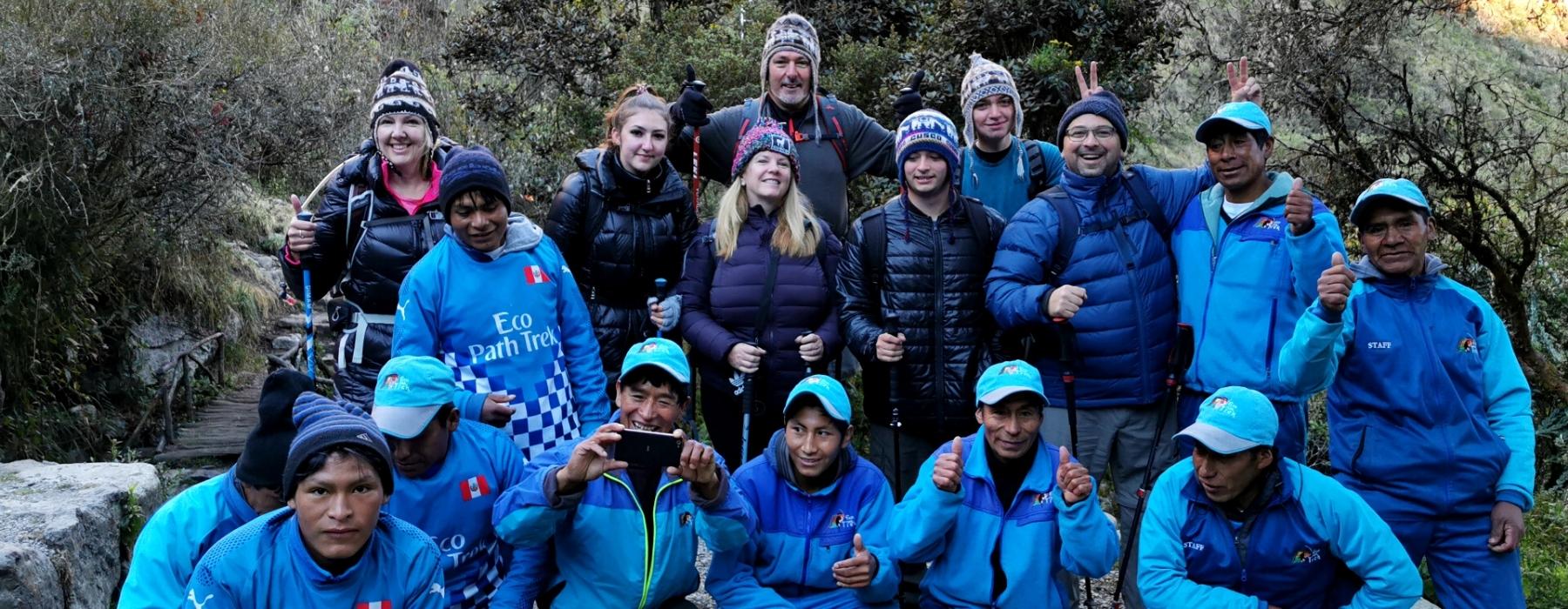
The ruins of Salapunco, although in certain cases they show carefully worked stone blocks, do not offer the elegance of the finish of other nearby archaeological remains, such as Ollantaytambo, although this group is not included in the Torontoy group. During an inspection, the historian Victor Angles noted that the plan of Salapunco alludes to the figure of a bird with an easily identifiable head and beak. This is yet another case of iconographic architecture. During Hiram Bingham’s first expeditions to Machu Picchu, the local inhabitants of these communities showed him these archaeological remains, but he was not surprised. Today it is possible to visit this Inca site, when tourists travel the Inca trail in 5 days, along the so-called valley floor, enjoying the beautiful landscape of the Ollantaytambo valley, the Veronica snow-capped mountain, and the Vilcanota river. Not many visitors pass by this site, if you are interested in history and ancient architecture, it is highly recommended that you explore this Inca site.
Another of the groups in the Torontoy complex is Khanabamba, located at kilometer 85 of the Cuzco-Machu Picchu railway, on a plain worked by human hands. It comprises a “building with two lateral enclosures with opposite facades”, which are separated by a central wall, as well as a row of 9 enclosures, plus others scattered around the area. During the Inca period, this site played a very important role, since all the expeditions of visitors and llama herders passed through there, heading to the citadel of Machu Picchu.
This was used as a place to spend the night and to supply food for travelers to Antisuyo (Amazon). Products such as corn, beans, tomatoes, quinoa, kiwicha, and coca were produced on the large esplanade. Part of this production was stored in the circular granaries found on the upper part of the hill. Likewise, a person in charge was responsible for ensuring that all visitors were well cared for, offering them water, chicha, food, weapons, and clothing. Technically, it is believed that Inca travelers made the journey from the town of Ollantaytambo to Khanabamba in one day.
This was also used as a checkpoint for all travelers and messengers who brought information from Machu Picchu to the capital of the Inca Empire. In Inca times, messages reached the capital in a couple of hours, thanks to the skillful Inca runners.

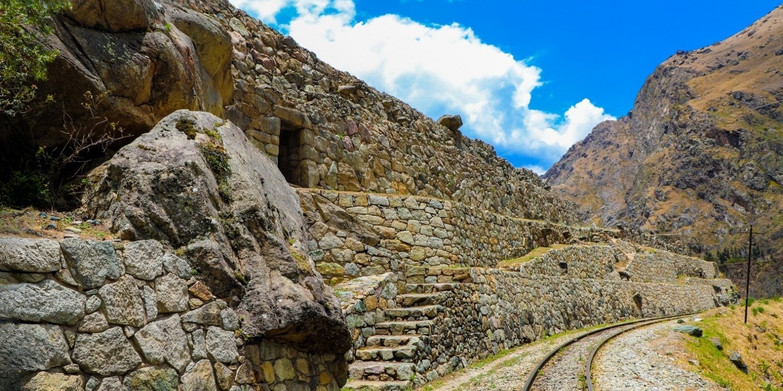
The Torontoy archaeological group itself is located at kilometer 91.5 of the Cusco – Machu Picchu railway. It is also known as Inkaraqay. Torontoy comprises the following archaeological units:
The site comprises enclosures with impressive doorways, made up of walls of polygonal stonework reminiscent of that of Hatun Rumiyoc in Cusco. Particularly notable is a carved stone with 40 angles, which is located on the north wall of the so-called Central Palace. The Wayraqpunku site should also be mentioned, along with several other groups included in the Torontoy complex. These have simple stone walls, but others were built with great technical skill in terms of the carving and polishing of their doors.
The Torontoy Archaeological Complex was part of the Royal Lands of the Inka Yupanki, this site was annexed in the process of expansion of the Tawantinsuyu State. Upon the death of Inka Yupanki, several of these sites were characterized by fulfilling an eminently religious and ceremonial function to the tombs, “what was planted there was clearly for sacrifices and ceremonies for the families of the emperors. The Spanish invasion possibly caused the locals to stop working the land, approximately for a period of 30 to 50 years, until the Convent of San Agustín rented land to private individuals, including Torontoy, for the planting of corn and wheat.
The German Augusto Rodolfo Bems (1887) with ambitious vision, arrived in Peru, settling in the Archaeological Complex of Torontoy, property of Manuel Angulo Guillen, landowner who rented him part of his property, to set up a company for the exploitation of wood that was abundant in this sector and sell it as sleepers for the railroad.
According to these sources, the society that lived in Torontoy in the Inca era, had skills in medicine, as can be seen in the report of Emilio Gutiérrez de Quintanilla (January 5, 1916), a technique probably adopted from the Cañarí mitmakunas and possible settlers in Torontoy; as we well know, the society of Tawantinsuyu was characterized by interaction with other regions. A clear example is the different traces found in the Historic Sanctuary of Machu Picchu, such as northern pottery, Chimu vessels, a bottle-shaped plastered tomb of coastal origin, the burial of a child in an urn (typical pattern of Ecuador), etc.
Hiram Bingham’s expedition took 08 mummies, 140 pots and champis (bronze objects) from the archaeological complex of Torontoy, to then be carried in wooden boxes worked by Binghan and his collaborators, in each box they placed a mummy so as not to destroy it, the same ones that were transported on mules, one by one along the narrow road. Faced with this activity, the population that lived in the Hacienda “San Antonio de Torontoy”, observed with indifference and fear the sacrilege that foreign people committed and fear of being punished.
Torontoy is undoubtedly a town (llaqta) with complex urban architectural characteristics, which served as a connection between Cusco, Machu Picchu and Ollantaytambo. The archaeological complex of Torontoy is characterized by having been reoccupied, from the Inca period to the present, which meant structural modifications in the different stages of occupation of the archaeological site. One of the characteristics of the foundation from the Inca period is that it is not horizontal but rather irregular, which has to do with the geological management they had, which is why the base of the foundation can be found a short space from the surface on one side while on the other the foundation is deeper. The walls built later are at a shallower level than the Inca foundations, supported by the structures of the Late Horizon. The use of adobe in its gables is from a later period than the Inca, even modifying the originality of the roof as well as that of the enclosure. Several structural modifications apparently were due to the fact that various enclosures were collapsed; It has been observed that several structures of some walls have remained in their original Inca state, since some of them have left some characteristics such as niches and openings, while in the other walls these details no longer exist. The discovery of the foundation in the courtyard of the original wall is a clear example of this. This evidence, plus the archaeological context, indicates that the site was collapsed before the structural modification and that it probably occurred during the Republican era.
The findings also reveal the occupation in different periods of the history of Peru, since the evidence in upper levels such as glass, rail nails, wires, etc. indicate that the site had a lot to do with the laying of the rail and that some buildings in sector B of Torontoy were used by the workers of said work. The evidence of Republican material such as collection vessels imported from Europe indicate that it was during this period that there was greater economy of the people who inhabited Torontoy at that time.
The little evidence of Colonial material reveals that there was no relevant occupation in this archaeological complex. The Inka context reveals the activities of a small village with different activities, its own rules and principles. Its management of space constitutes the relationship with other places arranged around the river. Finally, these sites were abandoned. Torontoy is part of this, but subsequent occupations did not occur immediately.
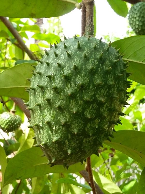
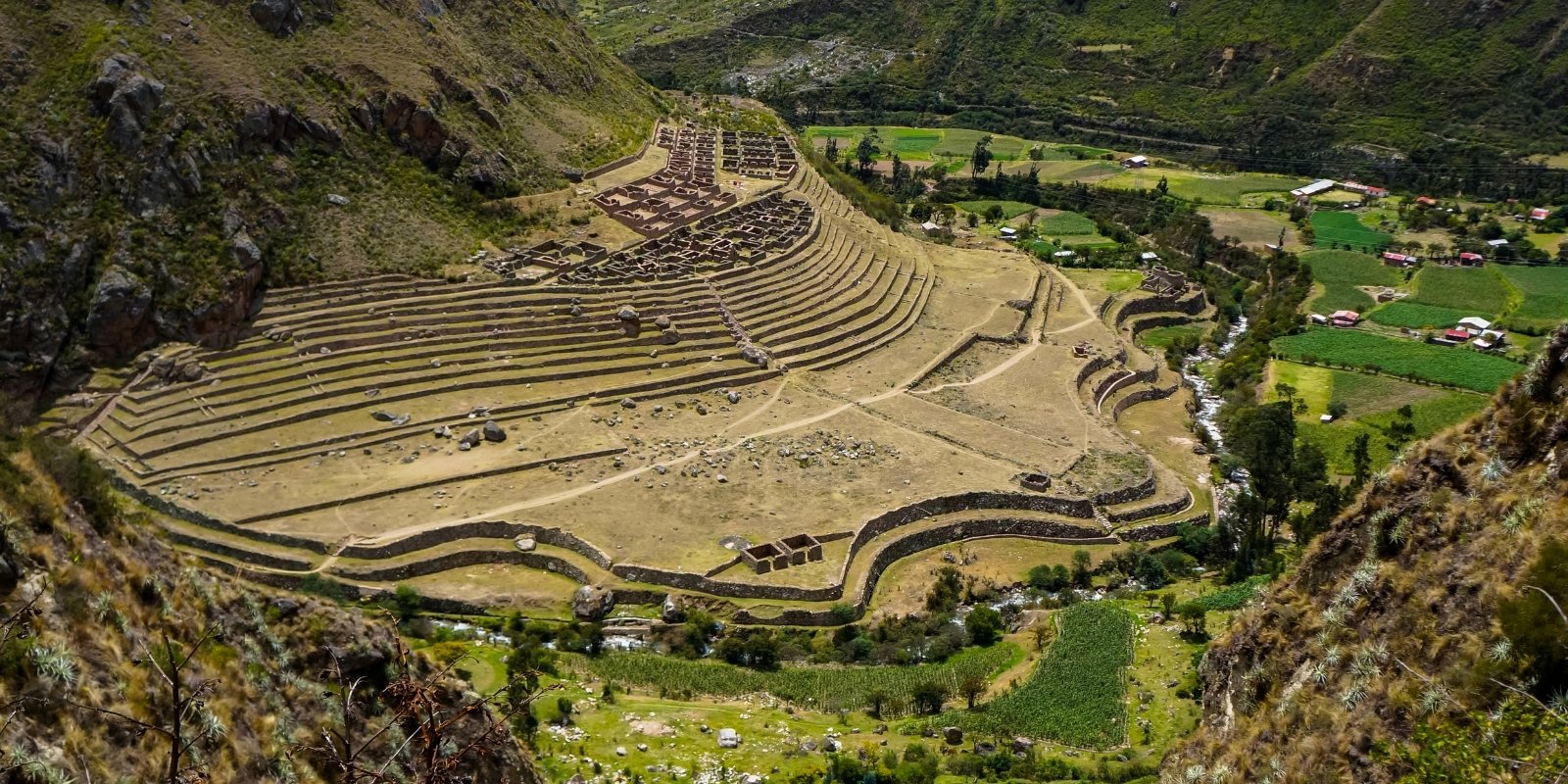
The extensive archaeological complex of Llaktapata is located on the left bank of the Vilcanota, about three kilometers from the Qoriwayrachina bridge. On one side, there is what must have been a shrine, Pulpituyoc, which was the religious center where ceremonies were held in honor of their gods. The Inca site of Llaktapata is one of the largest in the entire network of Inca roads that lead to the citadel of Machu Picchu. It is believed that this site was one of the largest centers of agricultural, textile and pottery production from where the Inca citadel of Machu Picchu was supplied. It was probably inhabited by more than 1,000 inhabitants. On their agricultural terraces the Incas planted different species of corn, potatoes, olluco, chili, squash, beans, fruits such as papaya, soursop, pacay, aguaymanto, achira, sweet potato, yuca, and coca leaves. When the first Spaniards arrived, this site was abandoned and destroyed by order of Manco Inca, to protect the sacred city of the Incas.
LLaktapata is located on the edge of the left bank of the canyon that forms the Cusichaca. The complex extends over 2,300 meters of altitude and includes groups of enclosures, as well as very extensive terrace works. A view from a distance allows us to appreciate that the two levels of terraces, which are located in the lower sector and limit the complex, take the form of the sinuous edges of a seashell. Perhaps this was also intended to evoke the sea waves, when they are lost on the shores of the coast. In both cases, this recreation must have been intentional and undoubtedly hides a symbolic value, which should not be surprising given the accentuated cult of water in ancient Peru.
In addition, the building included in the Llaktapata complex and known as Pulpituyoc, according to Siles’ observation, also alludes to a snail, following in this what is seen in the form adopted by the so-called Torreón de Machu Picchu, as well as the apse sector of Koricacha in Cusco. The Llaktapata complex, if it had evoked a shell of the family of osteroides, would explain not only the reason for the sinuous contours at its ends, but also the reason for the bulge where the various groups of enclosures are concentrated.
Llaktapata would thus join other examples of iconographic architecture detected by the author, such as Chavín de Huantar, Cerro Blanco in the Nepeña valley, Paramonga. The same is true for the city of Cuzco itself, which was outlined with the body of a feline and the head of a falcon, with its crest taking the form of points that seem to evoke the image of lightning at the same time. The successive rows of platforms sit on a topographical bulge, above the esplanade formed by the upper platform. At the top, the various enclosures are crowded together to form a larger group, which is considered the “urban sector” of Llaktapata and which includes more than a hundred enclosures.
Most of the enclosures were possibly food stores, taking into account that the sites located in the Historic Sanctuary of Machu Picchu must have served as centers for the production of food intended to promote good harvests. A short distance from Llaktapata, on the left bank of the Cusichaca River, are located architectural complexes such as Tunasmoco, Wilkaraqay and Lioniyoc.
After crossing to the left bank of the Urubamba by the Qoriwayrachina bridge, the extensive terrace works of the Q’ente complex can be seen in the distance, to the west and among groves of eucalyptus trees, with its sectors of Machu Q’ente and Huayna Qu’ente. Machu Q’ente comprises a succession of 10 cultivation terraces, in addition to other smaller ones. For its part, Huayna Q’ente presents a set of enclosures, which are entered through a superb double-jamb doorway, as well as several groups of terraces. In the archaeological complexes of Q’ente, Inca architecture is evident, where one can observe enclosures, open spaces and an architectural structure of a ceremonial nature called Waka, a sacred place, where ceremonies and rituals to Pachamama and other Ápus existing in the area were probably practiced, articulating the super-structural world in the social psyche of the population settled in the place.
The study area (Waynaq’ente) is located within the life zone of the subtropical montane humid forest, with a semi-humid and cold climate, approximately between 2,000 and 3,000 m.a.s.l. In it, grasslands, dwarf forests and cloud forests can be seen. It has been recorded that various kinds of species develop in this area, from birds to the spectacled bear. The Waynaq’ente Archaeological Complex in its geological composition presents granites, granodiorites of grayish white color, of granular holocrystalline texture, composed of quartz, orthoclase, plagioclase, there are also rocks corresponding to schists, which were extracted from the slopes of the Kusichaca River. The soils are of alluvial and colluvial origin, of acidic nature due to the presence of granite, geotechnically this corresponds to a SM soil of medium compactness, with an admissible load capacity of 2.05 kg / cm2. The outcropping rocks such as granites and granodiorites are moderately weathered on the surface, showing a yellowish color due to chemical alteration.
The Waynaq’ente site is located on the top of a natural plain on the north-eastern slope of the Casamentuyoq Hill. The location and subsequent construction of the enclosures was clearly planned. The Inka engineers also took into account the environment that surrounded them and the resources that the area had. The set of structures is located between two streams from which water was provided for the construction work. In its spatial organization it presents enclosures, passages, plazas and roads, articulated to a common axis, which were distributed by someone’s decision and need.
The topography that Waynaq’ente exposes is irregular, showing plains, slopes and ravines that defined the position and circumstantial forms of the structures, and the modification of the same allowed a better management of space. The topography also determined the layout and construction of irrigation networks and a road network. Based on the knowledge of topography, it was possible to implement precise surveying methods and bold engineering techniques for the construction of buildings, canals, bridges, roads, terraces and platforms with which they considerably expanded the cultivable land in a rugged geography, on whose slopes it would have been a chimera to attempt any form of agricultural exploitation.
The land in Waynaq’ente offers areas for cultivation that were achieved by adapting and leveling the soil through the construction of artificial terraces. Likewise, in the ravines, retaining terraces were built, which would support the structural load of buildings located on the upper part, while on the flat surfaces enclosure structures were built. Waynaq’ente is located at 2,800 m, above sea level. For this reason, it had access to products from the warm zone or Yungas, such as corn and fruit trees (low valley of Vilcanota) and products from the Puna, such as potatoes, chuño and other tubers, as well as the harvesting of dehydrated meat “charki”.
Access to the study site is difficult. To access Waynaq’ente, one climbs the path that ascends and borders the northern part of the slope of the Casamentuyoc hill. However, this was not an impediment to the construction of structures in the place. Part of the route along the slopes of the Casamentuyoq hill was conditioned by stone steps.
Most of the foundation of these walls was placed on the rocky outcrop, while others were built on a layer of compacted sand, until reaching adequate levels. The construction of the foundations of the walls is also found on large stone elements corresponding to the Batholith of Machu Picchu. The terracing system was built by adjusting the topography of the area using retaining walls parallel to the slope, which have been filled with local material, consisting of three levels. The lower level was filled with stone waste from the quarry (the product of roughing). This is located on the original level of the slope, providing greater permeability to the upper layers, which are overlain by the foundation soil.
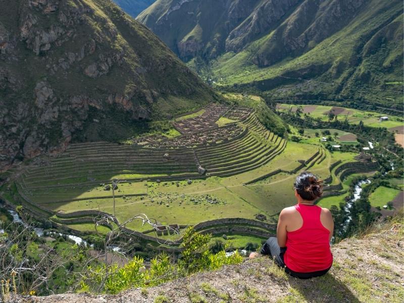
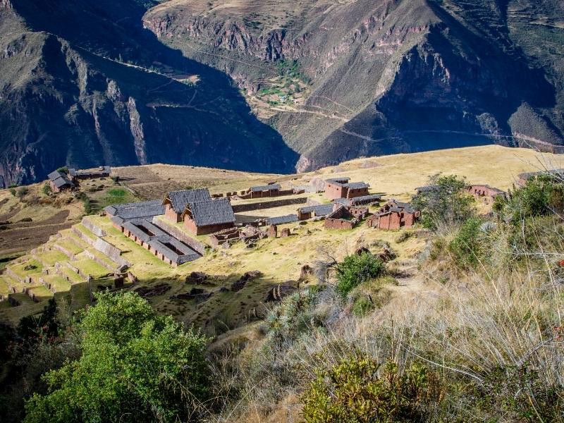
The archaeological group of Paucarcancha is located about 3 kilometers from the town of Huayllabamba, near the source of a tributary of the Cusichaca that drains into the Huayllabamba. The site is reached by turning off the Inca Trail, heading south until reaching the town of Paucarcancha, where the ruins of the same name, consisting of enclosures and terraces, are very close. The site of Inkaraqay is located near Paucarcancha. It is a unique complex in its form, due to its “triangular outline at the top pointing downwards” and because seen from the top of the surrounding hills “it looks like a snail or a cone of circular ornaments that follow one another in parallel towards the top.” The upper part of the group corresponds to a circle that shelters buildings interspersed with patios, and that “the peripheral line is made up of two concentric walls drawn and built with perfection…”. It is believed that it must have been a “tambo, that is to say, an enormous collective inn, to provide rest and food to travelers”.
The Inca ruins of Paucarcancha are an important point, which in the time of the Inca empire was also used as a control point for all pilgrims arriving from the north of the empire, since through this route the valleys of Mollepata and Limatambo were connected, which are on the route of the Inca road in the direction of Lima. These travelers crossed the entire Andes mountain range in the company of their llamas, which brought loads of objects highly appreciated by the nobles of the royal families such as: spondylus beads, gold objects with lapis lazuli inlays, turquoise, ceramics, dehydrated fish, chili peppers, feathers. A very similar culture that developed at the same time as the Incas was the Chimu, so much so that some of the children of the rulers of these people were forced to visit and stay in the Inca citadel of Machu Picchu, proof of this are the bronze objects and ceramics of the Chimu style found in the excavations, during the expedition of Hiram Bingham in 1911.
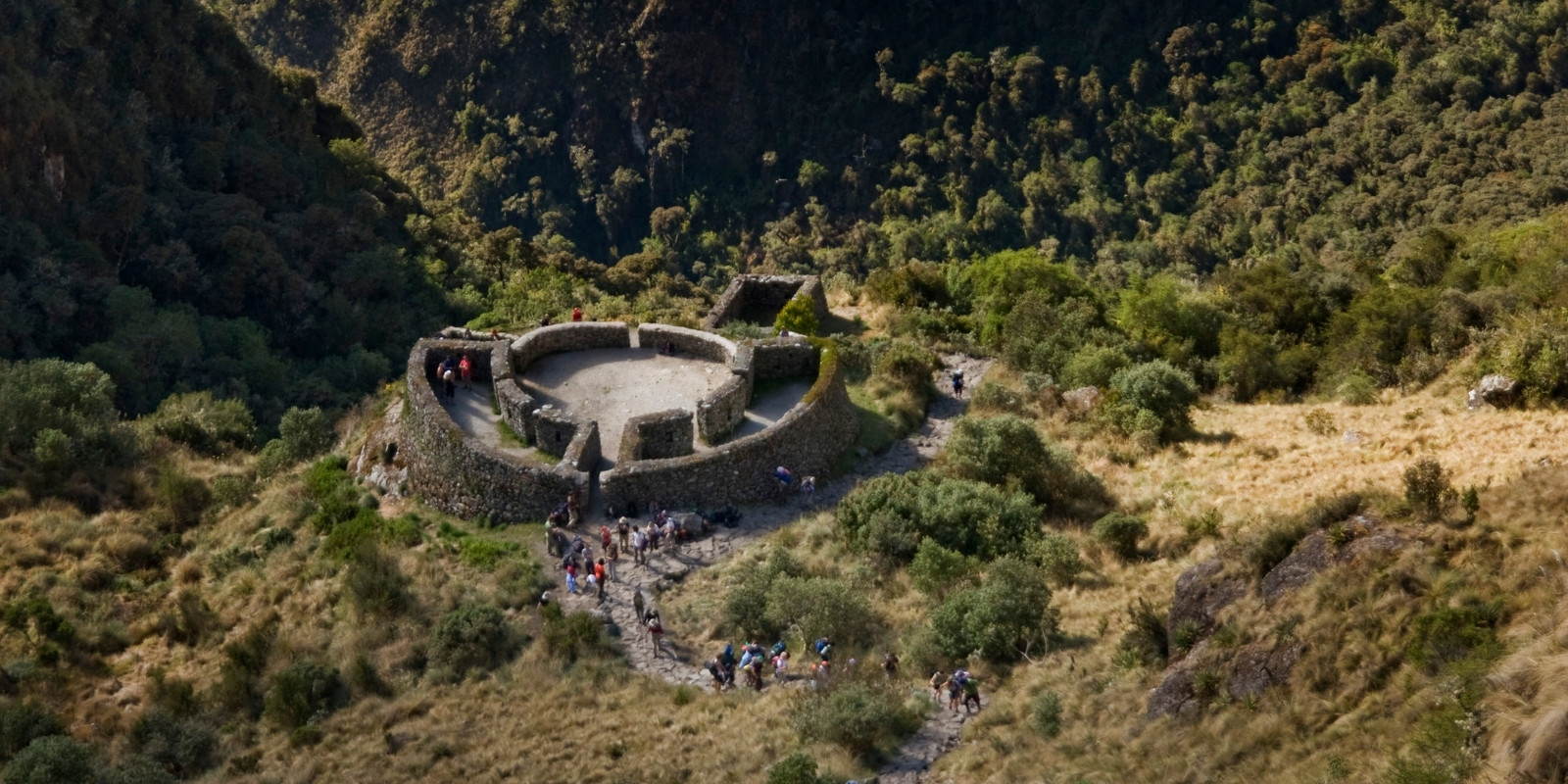
It was named in 1915 by Hiram Bingham’s Quechua-speaking assistants. It is a circular, slightly elliptical construction, built in the pass of the same name and located at an estimated altitude of 3,800 meters above sea level. Its access is through an entrance that leads to a passage 4.50 meters long and 2.20 meters wide, which in turn leads to an equally circular space. The diameter of the entire construction is close to 20 meters. The two circular and equidistant walls enclose five rooms, three of them spacious and two small. Access to them is through openings in the aforementioned circular courtyard.
About 20 meters southeast of the circular construction there is another rectangular construction whose length is about 10 meters. Runkuraqay contains the word runku and not runtu, which means round, egg. The word runku exists in Quechua and, therefore, it is not a degradation of runtu, as is often believed. In the Quechua of Ancash it survives with the meaning of “deposit”. According to Donato Apolín Gamarra, it is certainly interesting to observe the similarity of the Runkuraqay construction with a building present in the ruins of Yayno, in Ancash.
In Inca and Andean philosophy, there is the conception that the origin of all things was the great cosmic egg, which they called IlaTeqsi Wiraqocha or Kamaquen, the giver of life. This symbol is represented on a golden plate in the temple of the sun in Korikancha, which was made by the indigenous chronicler, Juan de Santa Cruz Pachacuti Yamqui Salcamaygua, is one of the few chroniclers who established the real condition of the gods and beliefs of the Incas. Thus, Runkurakay was a center of astronomical observation, which established the most important dates in which the festivals of the agricultural calendar were carried out, this site was inhabited only by the most recognized priests of the Inca empire, who emotionally and spiritually prepared all the travelers who came to Machu Picchu.
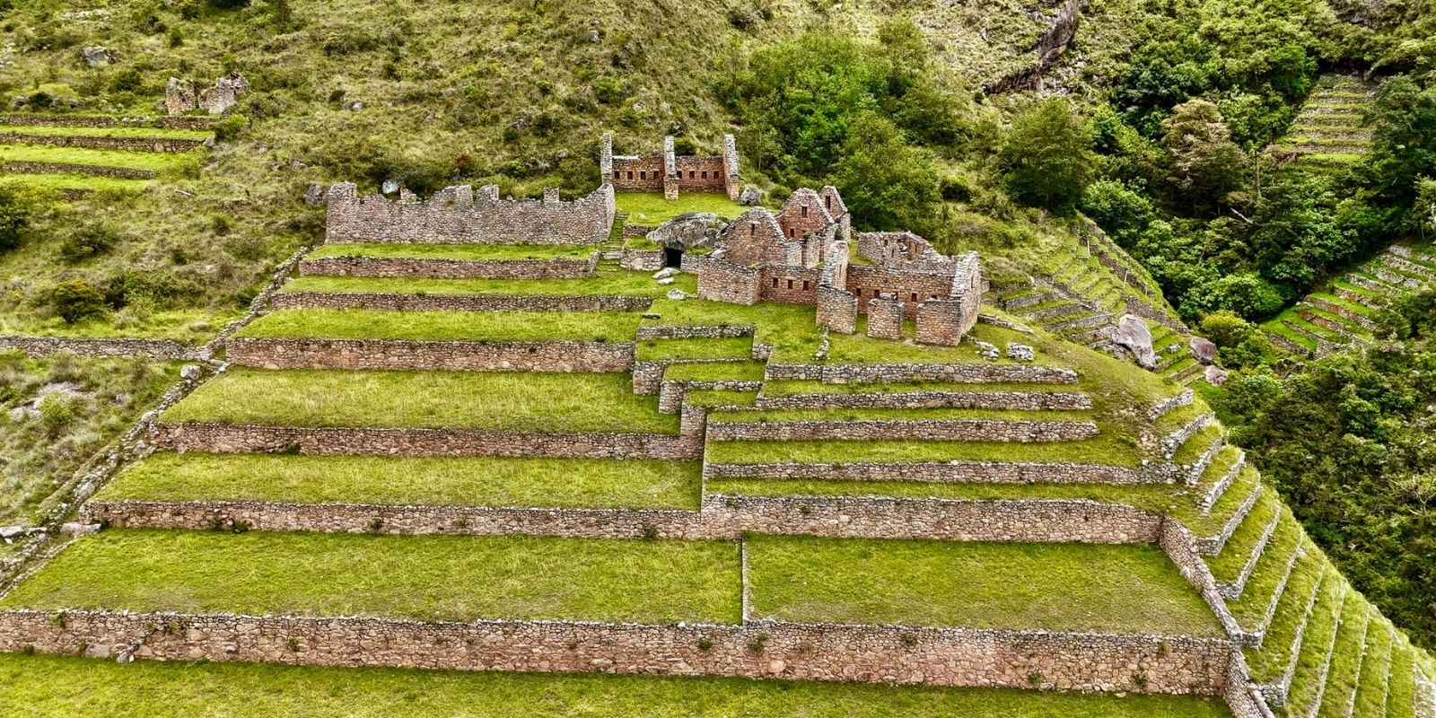
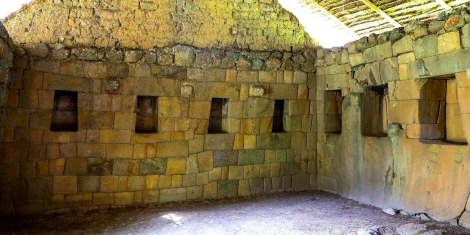
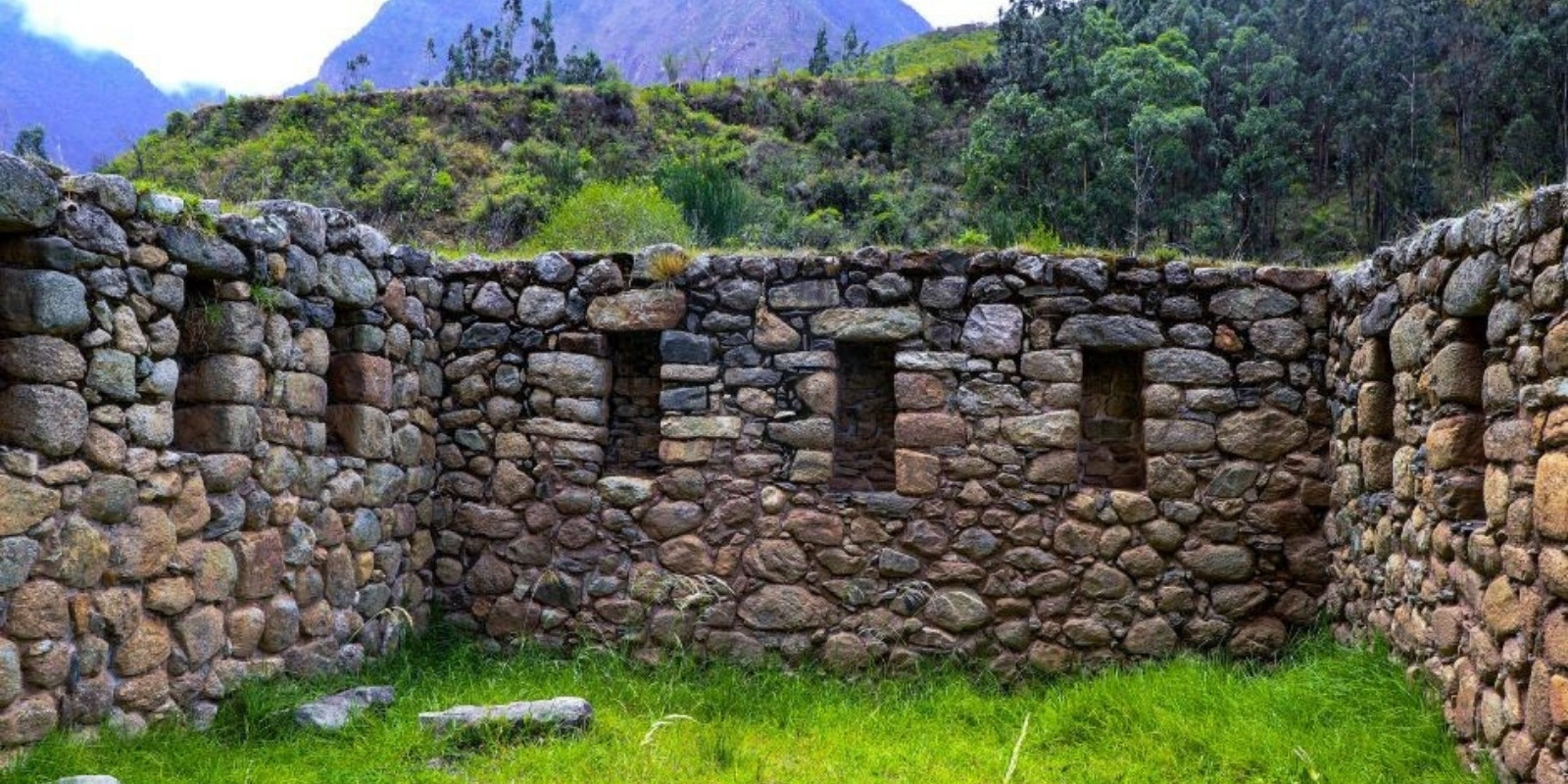
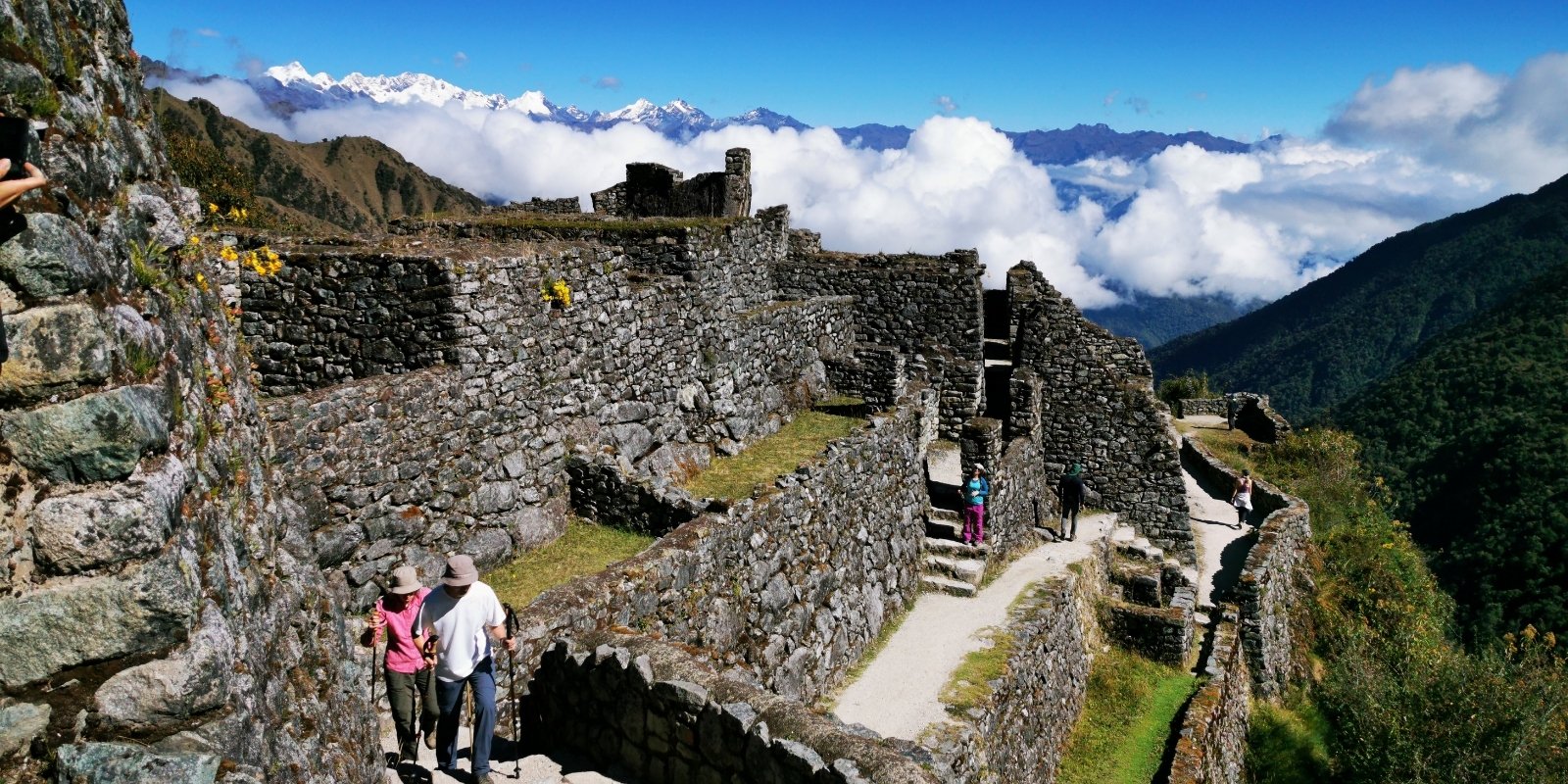
Visited in 1915 by Bingham, who named them Cedrobamba, collecting information from those who accompanied him on his expedition. The ruins of Sayaqmarka were studied in 1941 by Paul Fejos, who deforested them for that purpose and then renamed them Sayaqmarka, which means “high village” or “inaccessible city”. Later, in 1984, Wilbert San Román and the architect Américo Carrillo carried out cleaning and consolidation works on the site. With an estimated surface area of 3,500 m2, the ruins of Sayaqmarka rise on a promontory located at 3,575 meters. They have three areas with groups of buildings. The first “is on a dominant prominence and its main building is a tower with many windows and granite niches; it actually controls the entire citadel”.
The second group of buildings connects with the previous one by a wide staircase that leads to two sections. “Here there are 12 buildings with stone ring ornamentation that undoubtedly served to control the system of their doors. Some of these stones seem to have been in the process of being carved. There are also stone cylinders or nails in the upper part of the walls.” The lower group, or third, is to the west of the “city” and is made up of nine buildings plus two smaller structures.
The Ruins of Sayaqmarca are configured as a mini city, since it has all the characteristics of the large cities of the Inca empire. This site controlled the two accesses of the Inca road to Machu Picchu, on the one hand the travelers who ascended from the valley of Aobamba, who traveled from the Amazon plains to the city of Cusco, and on the other hand the settlers who came from the mountains of the sacred valley. In order to preserve all the traditions and cults of these inhabitants of Tawantinsuyu, the Inca Pachakuteq ordered the construction of a building with all the facilities for food services, overnight accommodation, and a sacred space for prayer to their deities. Sayaqmarka has a small Ushno (ceremonial terrace), where coca leaves were offered to the sacred mountains. On the side there is a small channel of water that was collected from the mountains and distributed to two ceremonial fountains, which crossed the lower part where the Inca nobles surely used to prepare their food.
What is most striking is an environment in which there is a rock, whose surface was carved with the figure of the Inca Pachakuteq, who is being carried by his servants on a litter, and he is pointing with the index finger of his right hand in the direction of Machu Picchu. Many of the rooms were roofed with local material, such as bamboo, wild cane, and straw. For this purpose, the Inca architects used lianas, and the help of stone nails ensured the stability of the roofs. Very close to the lower part on the side of the Inca road, there is a small archaeological center that scholars call Konchamarca, since it resembles a clay oven. The Incas possibly used it as a storage center for the products and objects that were used in Sayacmarka.
This archaeological group was explored by Hiram Bingham in 1915. The sites known today as Phuyupatamarka were given this name by Paul Fejos. Previously, Bingham referred to them as Qoriwayrachina, a name that is repeated in the region and whose meaning would be “where gold is found”. Phuyupatamarka, on the other hand, means “town above the clouds”. In fact, these ruins rise in the middle of a hollow where the clouds remain undisturbed by the wind. The buildings of Phuyupatamarka are located at 3600 meters.
The site is made up of extensive cultivation terraces that adapt to the sinuosities of the terrain, as well as shrines probably intended for the worship of water. Its stones were worked in white granite. During the clearing of the undergrowth that allowed Fejos to explore them in 1941, 4 groups of houses were located, 2 squares, a house with terraces, 6 fountains, 21 different staircases, 3 caverns, 2 channels, a watchtower-type platform, 2 tunnels with monolithic steps, various terraces and holes made in rocks. The largest structures are built on two promontories. “Both are almost symmetrical, each is composed of a large house, its terrace in the front and a semicircular tower. The facade of the towers has three windows.”
The cult of water dates back to the first Andean civilizations, who wisely had a great respect for the water element, which is why before carrying out a construction project, they first made sure there was a water source nearby. The Incas chose the site of Phuyupatamarka to exalt the water rite. These ceremonies were carried out in the month of October. The priests, led by the nobles, implored the good will of their gods. Thus, they used to tie up dogs and some llamas that cried looking at the sky to attract rain. It is very important to remember that water is vital to the economy of the Inca Empire, since if there was not enough rain, many of the towns were left with few food resources.
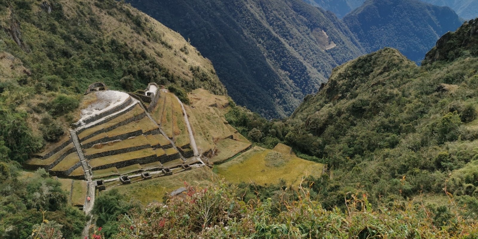
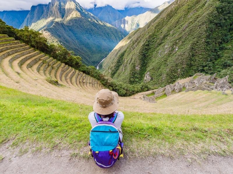
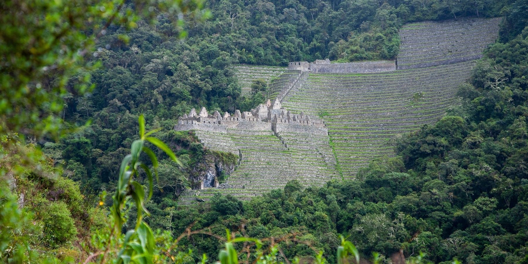
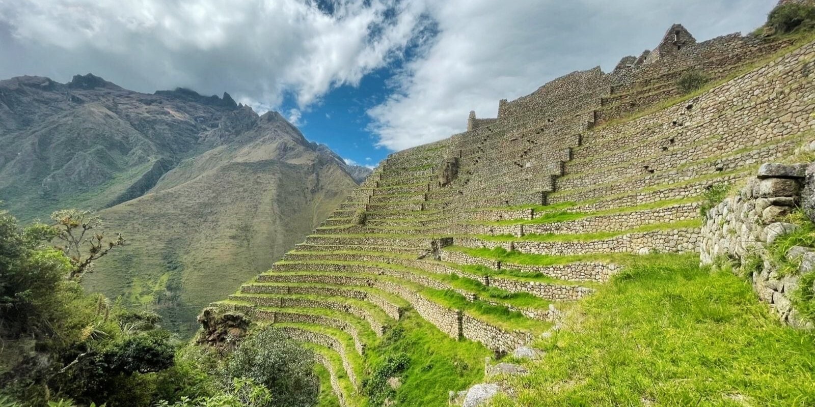
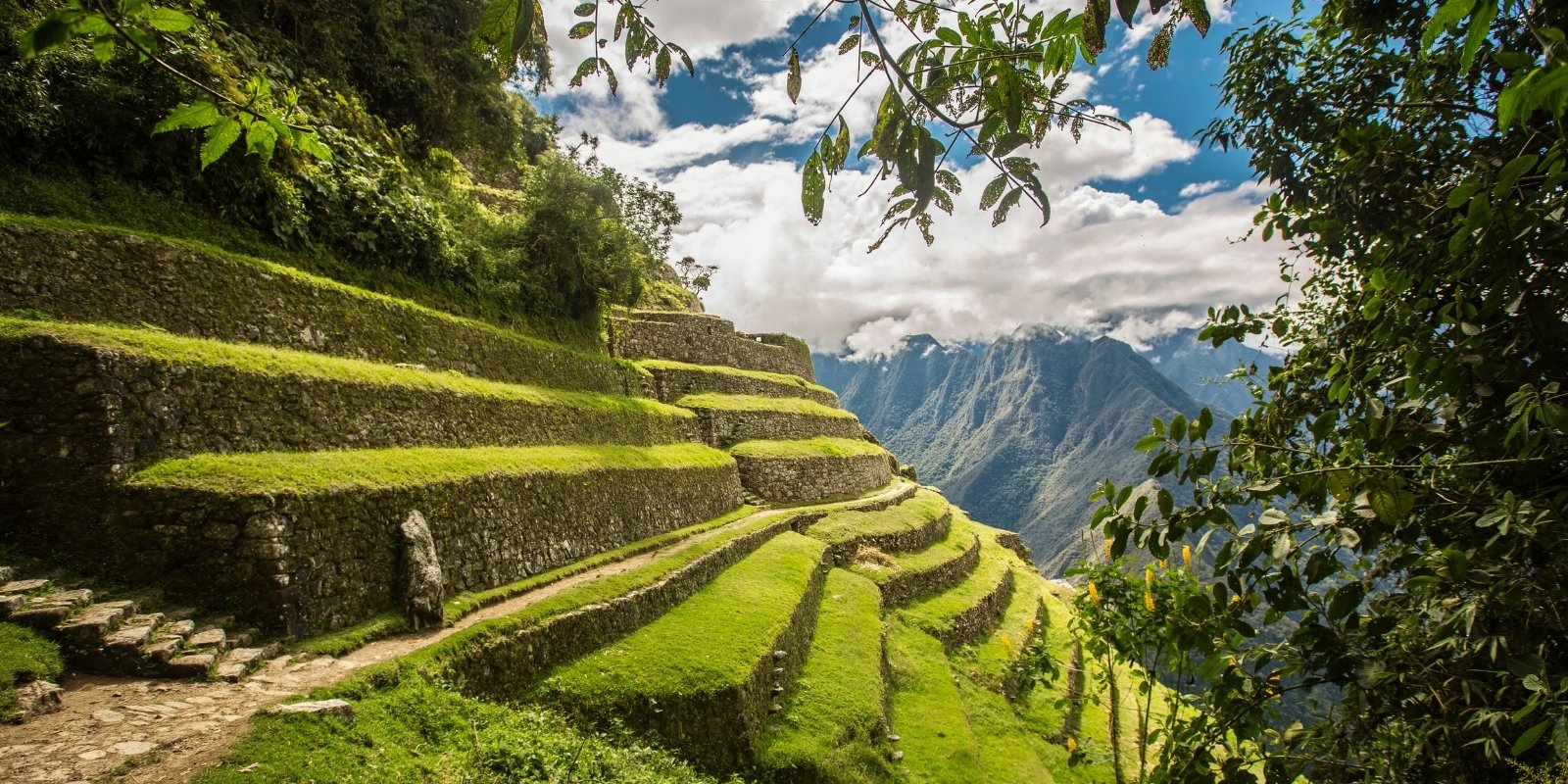
Name given to a group of ruins near Machu Picchu (just 2.5 kilometers away), south of this architectural complex, in the Cedrobamba area. They were unveiled in 1941 by Paul Fejos. Intipata is located at 2,850 meters, and consists of 48 terraces, 4 staircases and protruding stones that connect the terraces; it also offers 23 enclosures that record niches and doorways with monolithic lintels. Its very extensive terraces must not have only served those who lived in Intipata, since it is infinitely larger than the one occupied by the enclosures present in the place.
We consider that Intipata is further proof that Machu Picchu and the other architectural evidence of the Vilcabamba region were built within the framework of an Inca state project aimed at expanding the agricultural frontier, with a view to providing food to Cusco. The agricultural horizon in the time of the Incas reached its maximum splendor, which is why the Incas tried to make the most of the agricultural lands of the Cusco Valley and the Sacred Valley. With the growing demand for food by the inhabitants, they began to build terraces throughout the empire where many products of different species were produced. But a fundamental role of the Inca farmers was to determine which seeds were best adapted to each climate.
The main taxa of corn, coca, chili, fruits, and medicinal plants were distributed from the Amazon, and year after year they adapted from the lower level to the higher ones. Thus, the terraces of Intipata, apart from serving as agricultural land, were also used as centers for experimentation and the creation of new species capable of adapting to the high Andean valleys. In the lower part, you can see the astronomical center, where the Incas marked the exact dates on which they began planting each product. It should be understood that to obtain a new species of food product, it took at least 8 to 15 years. Inca scientists were always looking for new and better products so that all the inhabitants of the empire would have enough food.
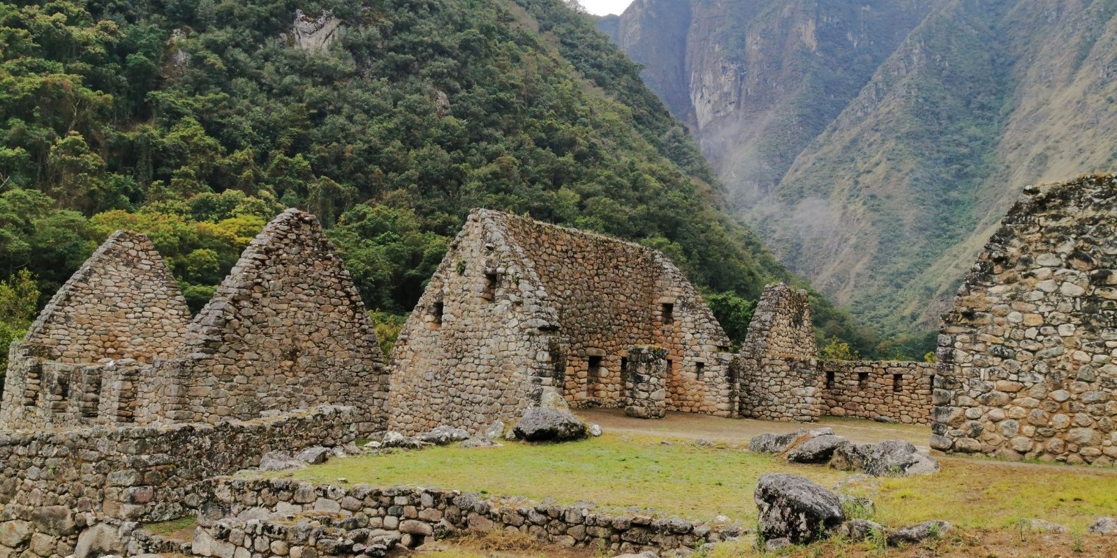
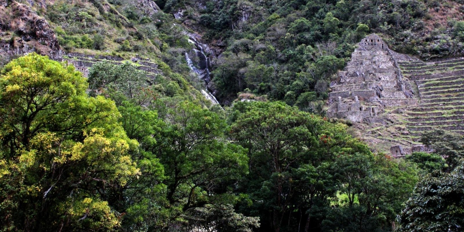
This archaeological site was first discovered and explored in 1941 by the Viking Foundation Expedition led by Paul Fejos. It was later baptized by Julio C. Tello with this name, which means “eternally young”, after a beautiful orchid (Epidendrum spp.) that blooms in the area occupied by the ruins of Wiñay Wayna. At the head of an expedition carried out in 1942 and led by Tello, Wiñay Wayna was partially deforested and investigated. The ruins of Wiñay Wayna are located at 2,630 meters, at kilometer 104 of the Cusco-Machu Picchu railway, above the town of Lucmachayoc, near the left bank of the Urubamba River.
They are made up of two groups of thirty rectangular enclosures, some of which have wide openings. The complex known as El Torreón is located at the top of the archaeological group. It is entered through a double-jamb doorway opened in the wall there. Some of the rooms in this group have wide trapezoidal openings. For their part, the rooms in the lower group, with their openings located at the top of the walls, seem to have been storage rooms and not dwellings, as is often believed. Wiñay Wayna is characterized by its extensive cultivation terraces or platforms, although not as wide as the adjacent archaeological complex of Intipata. The two groups of rooms are interconnected by a staircase to which 10 water fountains are connected, whose function must have been magical-religious. Víctor Angles Vargas points out that, to build Wiñay Wayna, the Inca engineers and architects “looked for a slight orogenic prominence and there they built something improbable, a town with fountains, viewing points, food stores and daring terraces. Wiñayawayna is the palace that belonged to the Inca Pachakuteq and was inhabited by members of his children and ancestors. Without a doubt this is the best preserved archaeological site just as its builders left it, many of the visitors catalog it as the most beautiful of the entire Inca trail network.
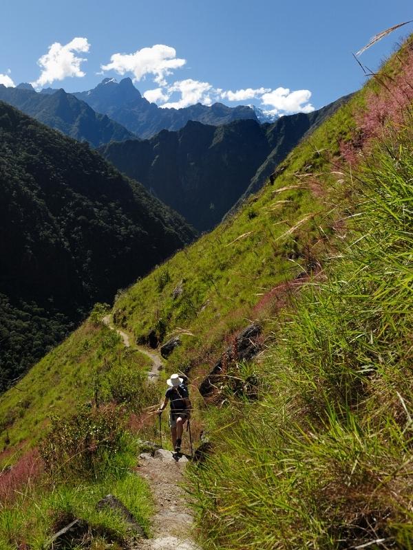
To visit this beautiful place you can access it by two routes, the first is by taking the classic Inca trail, which you reach on the third day, where you also spend the last night; and the second option is through the short Inca trail, which begins the walk at km 104, Chachabamba sector. The best season to visit this site is from April to October, when the climate of the Andes is drier and the sky is blue. In this site you can also discover some of the orchid species of the Machu Picchu National Park.

Paul Fejos investigated the site of Chachabamba, located in the upper part of the left bank of the Vilcanota-Urubamba River, at kilometer 104 of the Cusco-Machu Picchu railway. This archaeological site is located at 2,120 meters. It is made up of fourteen enclosures, fourteen water fountains, three stairways and various platforms. When observing the site plan, in one of the sectors a large, neatly carved rock can be distinguished that seems to evoke the head of an image of a bird. Chachabamba would thus join other examples of iconographic architecture, such as Chavín de Huántar, Paramonga, Pumamarka.
During the excavation processes, the recovered Inca ceramic material, in its great majority, was domestic objects. It was concluded that there is only evidence of an Inca occupation and that Chachabamba served as a point of articulation for the transportation of food. The presence of plaster remains on some enclosure walls was also noted, the inclination of the walls was determined, and the foundation levels were defined in relation to the original floors that were present in almost all the excavation units.
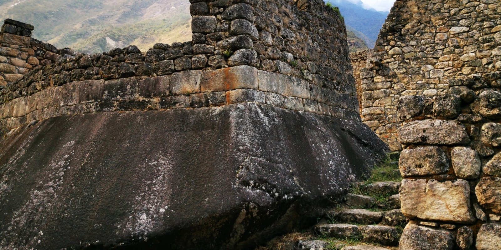
It is likely that, at first, the constructions in Chachabamba were basic, while, during a second moment, it was decided to carry out monumental constructions, which involved a redesign by leveling spaces and building the enclosures currently visible, in addition to the encapsulation of the Waka (sacred rock) with walls on three of its sides made of fine masonry in the first three courses (the first is fitted to the waka by means of alveoli), with the following courses presenting rustic masonry that has been intervened with restoration work.
The above shows that architectural modifications were made to the original design and/or reuse of previous structures, as has been reported mainly in settlements on the right bank of the Vilcanota basin. Regarding the canals, the collection point is located in the Chachabamba stream, from where, through the main line (partially recorded) and its distribution branches, the water is channeled to the agricultural terraces and ceremonial fountains. It is worth highlighting that evidence was found of the channeling of the Chachabamba stream to the west of the monument, close to its meeting with the Vilcanota River.
For its part, the kancha in patio 2 is related to the platform, and this in turn is linked to the canals and ceremonial fountains, which means that no space functioned independently. The architectural characteristics of the enclosures, the open spaces and the ceremonial fountains suggest that the functions of the enclosures were related to textile production, food preparation and ceremonial activities.
These findings, added to the architectural characteristics, are evidence that allow us to infer that one of the activities carried out in the Chachabamba archaeological monument was textile production. According to the analysis of Vásquez (2017), the carbonized remains found correspond to Zea mays (corn) and local tree species used for their wood and medicinal properties, such as Polylepis sp., Juglans sp., Cedrella sp., Alnus sp. and Schinus molle; the latter two are also used for dyeing textile fibers.
The analysis of the ceramic samples recovered from the monument allowed us to identify a varied typology, mainly of closed and open vessels, although no evidence of in situ production of these objects has been found. The largest percentage of the fragments correspond to the Late Horizon, that is, the Inca period; in the case of the diagnosed fragments, the painted decoration with geometric shapes stands out. In general, the closed vessels are the most represented (pots, aryballos and jars) and correspond to elements for the preparation and storage of food and drink, although, in the case of the discovery of a fragmented aryballos, this could be related to some type of offering.
As for the open vessels, they were used for the direct consumption of food –in the case of plates, bowls and bowls– or for libation –in the case of the glass found–. It should be noted that a large part of the ceramic fragments found in both research seasons had soot, in addition to having found fragments of charcoal in the matrices. A decontextualized bronze knife was also recovered, allowing us to infer that this space would have been related to ritual activities around the sacred rock. Chachabamba could have housed one hundred individuals, and the central courtyard would have allowed a considerable number of participants to gather.
The excavations also allowed the recovery of an obsidian flake and lithic hammers of different sizes. Based on the traces of use of these objects, it was possible to determine that some were used for stonework, while others were related to food preparation tasks.
A large part of the enclosures, mainly their internal walls, were plastered in red or yellow, as in the case of the llaqta of Machu Picchu. This shows that the population of Chachabamba had access to resources from different ecological levels and, on the other hand, indicates the probability that most of the agricultural production in the terrace system corresponded to corn as a consumer-offering product.
These ruins are located at an altitude of 2,150 meters, in a ravine on the left bank of the Vilcanota-Urubamba River, at kilometer 107 of the railway line. They flank both sides of the ravine of the same name that descends from the heights of Phuyupatamarka. Choquesuysuy was introduced to Peru and the world by Bingham. Later, in 1941, the Wenner Green Expedition, led by Paul Fejos and accompanied by Alexander Wenner himself, uncovered most of the remains comprising Choquesuysuy. These include more than two dozen remains of various kinds, as well as groups of terraces, all built in a steep ravine. Koechlin calls the path the “Path of Purification” due to the presence of the five large circular vessels located in the lower sector of Choquesuysuy. The five fountains were carved in stone, arranged in a row, and various planes and grooves were carved into them. The vessels descend in slopes, depending on the terrain. The function of these water containers must have been part of the cult of water. At the top or summit of each of the two sectors, there is an imposing structure. From here, a series of platforms descends the steep slope. Both buildings have two floors and are similar. At the top of the complex, traces of a second ancient path can be seen, projecting toward Wiñay Wayna, about 3 kilometers from Choquesuysuy.
The Choquesuysuy archaeological site has been divided into Urban and Agricultural zones. After investigation, it was concluded that it was a residential and administrative space, although it was probably also a ritual site. The charred remains of the roof beams inside the enclosures, for their part, suggested that the site was intentionally burned at the time of its abandonment. This hypothesis is reinforced by the limited presence of movable cultural elements found during the intervention. More than 90% of the ceramic material found corresponded to the utilitarian Inca type. Palynological analyses reported the presence of fossil maize pollen. Water for these tasks was conveyed through a main canal located in the upper part of the Agricultural Zone, which connected to a secondary canal located vertically in the walls of the platform platforms.
In Choqesuysuy, unfinished works are also present, such as those defined in the upper part, where segments of rustic walls were found that would be part of new platforms: future extensions of the terrace system (east side) and in the upper part of the south side, where walls cut in a staggered manner with evidence of continuity are shown. Likewise, three ceremonial fountains were recorded, which were buried and were in the process of construction, and the conduction channel was found that was in the same process. The burying of the platforms of thirteen platforms occurred after the abandonment of the monument, as a consequence of the overflow of the waters of the channel located in the upper part, which was no longer maintained.
The analysis of plant remains carried out by Vásquez (2016, 2017) in fragments of ceramics and stone grinding tools has allowed the identification of ancient starch grains corresponding to Zea mays (corn), Solanum tuberosum (potato), Cucurbita sp. (pumpkin) and Phaseolus sp. (bean).
In the study of macrobotanical remains obtained by mechanical flotation, remains of seeds of species of nutritional value were also identified, such as Zea mays (corn), Chenopodium quinoa (quinoa), Ipomoea batatas (sweet potato) and Amaranthus sp. (kiwicha); as well as wild herbs from the Fabaceae, Desmodium sp. and Convolvulus sp. families, which are associated with crop areas; in addition to a seed of the medicinal plant Ambrosia sp. (mugwort) and another of Cyperus sp. (rush). On the other hand, as a result of the analysis of archaeological charcoals, tree species (Alnus sp., Polylepis sp., Juglans sp., Budleja sp., Blepharocalyx sp.) and seeds (Rubus sp., Clematis sp., Euphorbia sp., Ipomoea sp., Carica sp., Carex sp.) have been identified in association with occupation floors and burning events.
With respect to the twenty-seven circular structures distributed on platforms in sector I, Rowe suggested that they apparently did not correspond to tombs or water reservoirs. The other possibilities he considered were spaces for planting bushes or for ornamental bonfires, which contrasts with what was proposed by Alegría (1998), who refers to them as temporary dwellings for the builders; for his part, Fernández (1999) has suggested that these structures could be spaces for drying and selecting products, such as coca leaves. However, considering the location of the structures and their analogy with those existing in the Agricultural Zone (upper part of sector V), in addition to their orientation mainly towards the east, functions related to rituals and probably to the cult of dead bodies are suggested.
Choqesuysuy responds to an expansive Inca policy towards Antisuyu (the Amazon) for the control of areas for extractive and agricultural purposes, mainly for corn, including ceremonial aspects. In addition to its architectural distribution, analogous to that of the citadel of Machu Picchu, the sacred character of Choqesuysuy is materialized in its ceremonial fountains, which are related to the cult of water and ritual ablutions, resulting in a space of purification before continuing on to Machu Picchu, which is about three hours away.