With great knowledge about the soil, Incas agriculture overcame both the adversities presented by the rugged Andean terrain, as well as the unfavorable climatic conditions, by adapting innovative agricultural techniques, which allowed organizing production in the geographical diversity of Tahuantinsuyo.
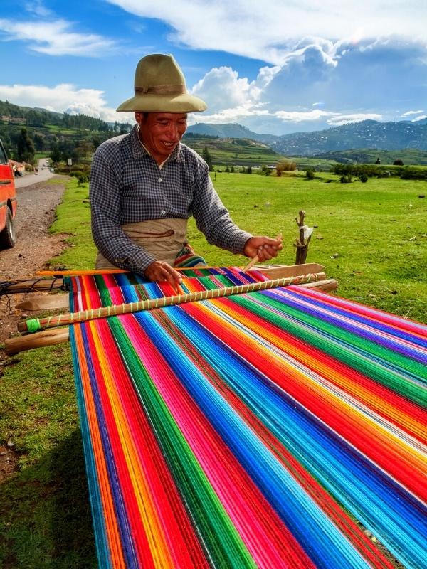
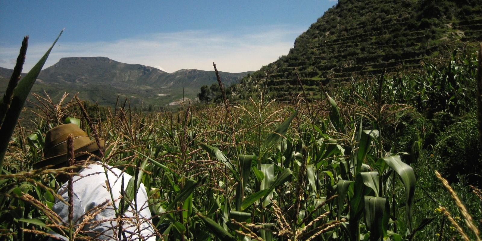
Inca agriculture as the main economic activity, managed to acclimatize a wide variety of products to the environment, in this way, they cultivated potatoes, olluco, corn, sweet potatoes and beans, among others. Thus, to till the land, they used the human-powered plow or tajlla, which consisted of a stick with a curved stone or metal point crossed by a beam at its lower end, which served as a support to sink the tool into the earth and open the grooves. Additionally, they used the manure of seabirds, called guano, and the fallen leaves of carob trees as fertilizers.
The basic activity of the Inca economy had always been agriculture, even in coastal areas where fishing played an important role or where trade generated wealth. Society, its interests or its culture, revolved around the land, seen as a source of life and the most precious asset, a source of disputes, wars and worship. The Incas deified her with the name of Pacha Mama.
The agricultural technologies they used were diverse, among them are the main systems and procedures in the management of productive resources such as soil, water and plants.
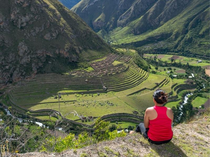
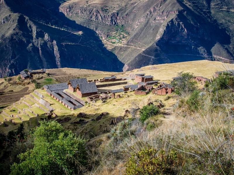
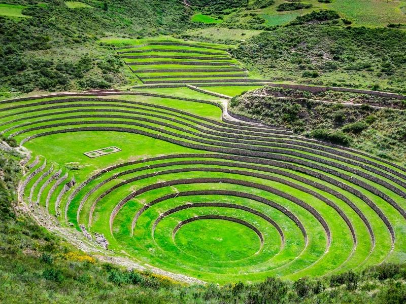
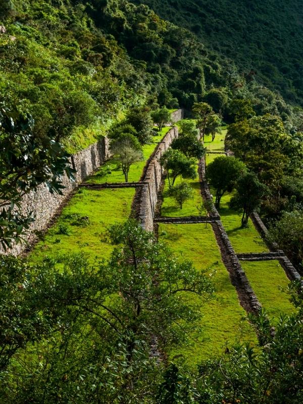
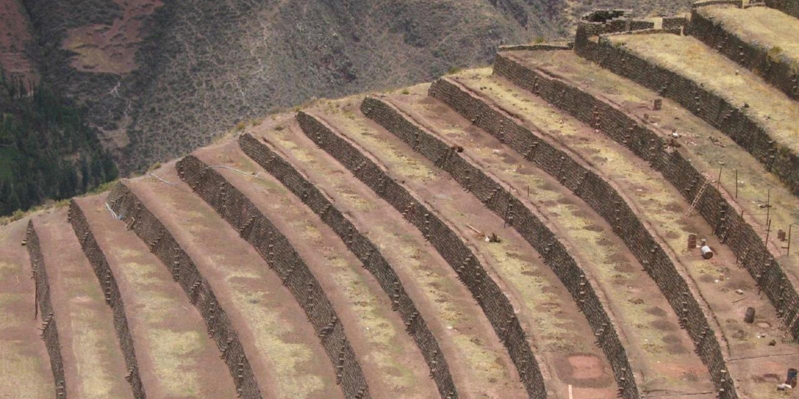
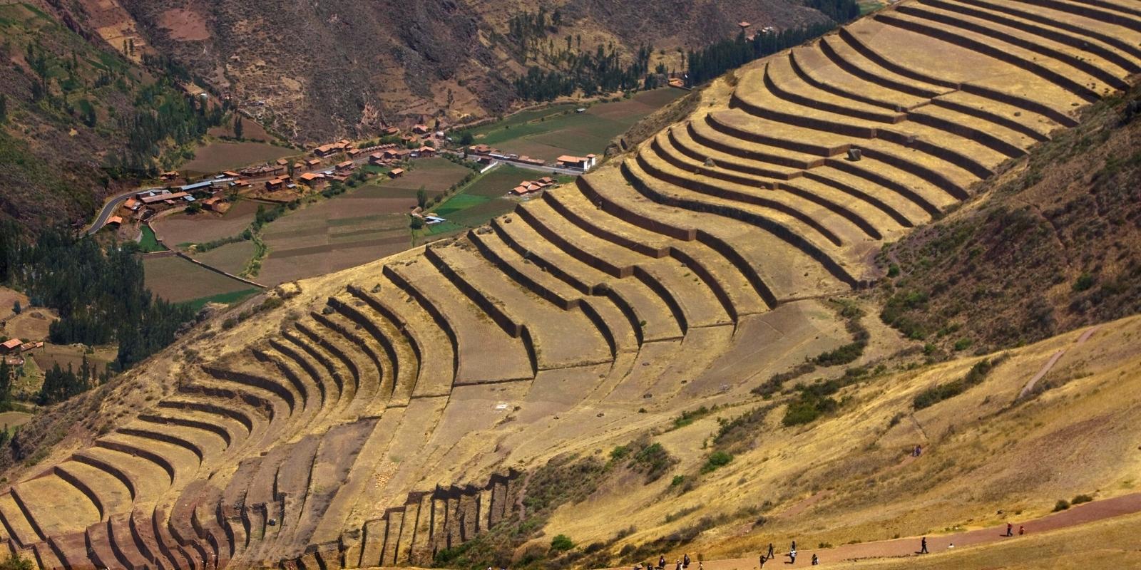
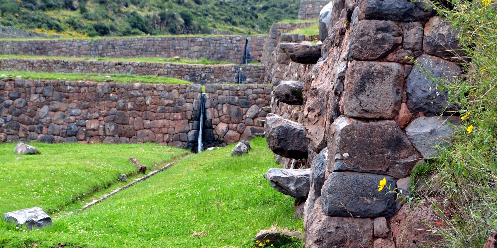
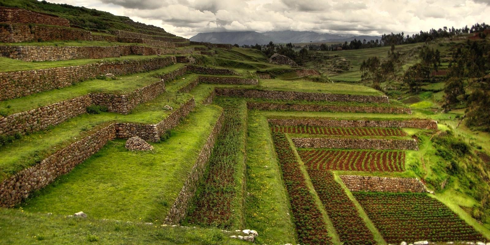
The lack of land also induced the Incas to build the famous platforms on the slopes of the hills. They were intended to make better use of water, both rain and irrigation, making it circulate through the channels that connected its various levels, and also prevent soil erosion by the action of rain and wind; To do so, they cut the hill in the form of steps, then they built retaining walls and in this kind of pots they filled three layers of small stone, sand and topsoil. The number of platforms is impressive, it is estimated about 20 million hectares.
The largest distribution of irrigated agricultural platforms is found in the mountains in the Quechua ecological zone (from 2,100 to 3,300-3,400 m), synonymous with the maizal agroecological zone. Under certain conditions they exist even in the Suni ecological floor and sometimes up to 3,800 m, if they have adequate sun exposure and protection from extreme climates.
Other platforms and terraces, lacking irrigation, in the Suni ecological zone (“Type 3” platforms) and even until the beginning of the puna (“Type 4” terraces), had a crop with the fallow and rainy regime, and in some cases are integrated into Laymes systems. Currently, due to population movements and migrations in the past, for the most part these platforms and terraces are abandoned, either progressively or spend long periods fallow and are increasingly used for cattle grazing.
The highest area of cultivation of corn (Zea mays) on platforms occurred in the altiplano, in the surroundings of Lake Titicaca, given the special conditions of the lake that cause a more temperate climate on its shores, at an altitude of 3,800-4,000 m. . It is estimated that in Tiahuanaco some platforms were built around 500 AD, part of which is currently under irrigation. An exhaustive investigation is required to determine if the irrigation canals are contemporary or if they were a delayed response to a great drought during the post-Tiahuanaco period. However, it is obvious that the rare platforms above 4,000 m were never irrigated, as were the highest platforms in Peru between the suni and puna zones. One of the highest platform systems that had irrigation is attributed to the Inca, those of the Sun Island, in Lake Titicaca (3,850-3,880 m altitude), destined for the cultivation of corn, probably for ritual purposes. Currently, the terraces without irrigation, located in the highest parts, are generally abandoned or used for cattle grazing.
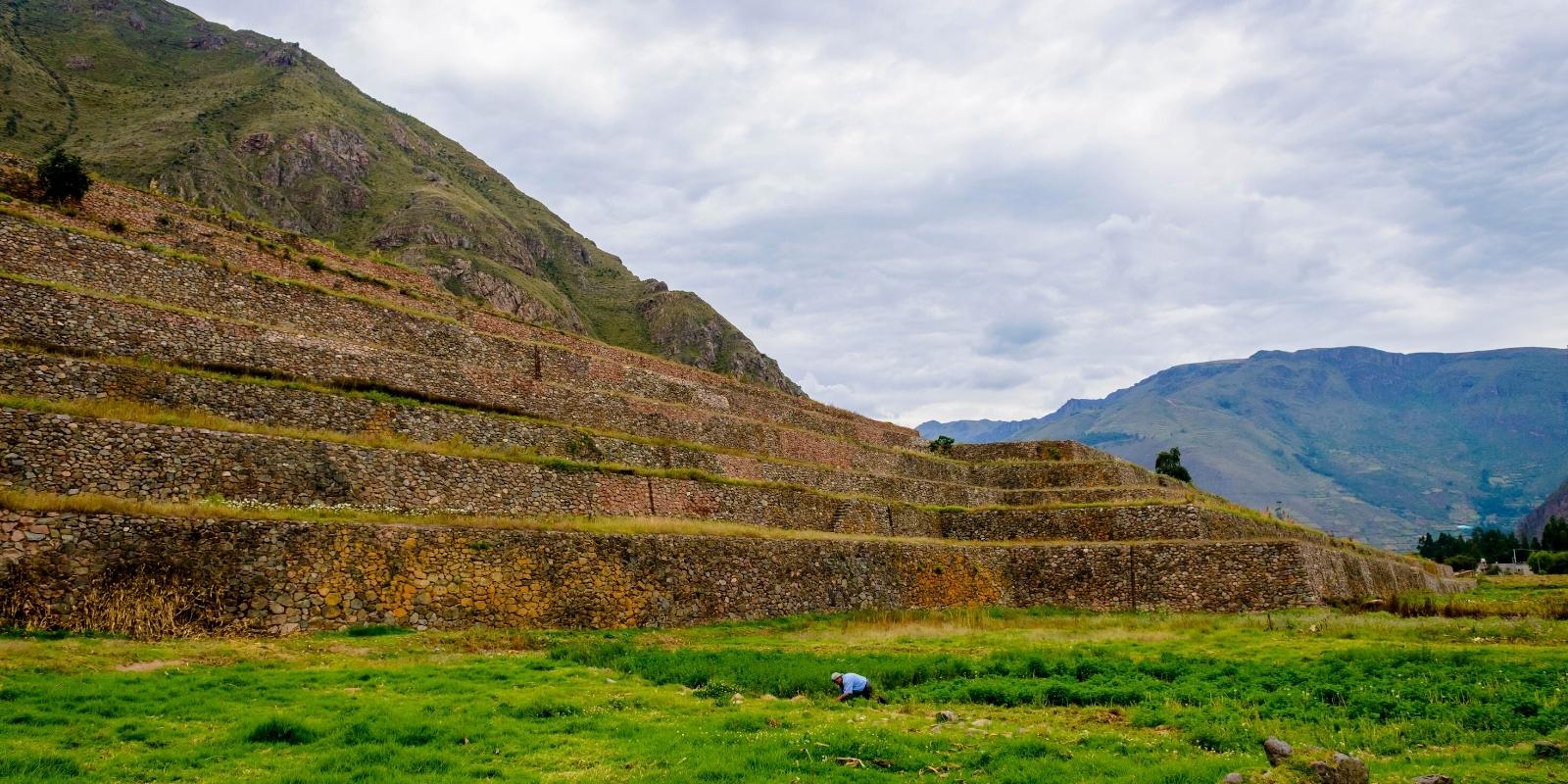
“Type 1” platforms: approximately horizontal profile platforms with sloping retaining walls, generally with irrigation.
Type 1 is Inca with Cuzco characteristics or derivatives. It can present variants in different areas and regions or where the Incas intervened during the Late Horizon. It generally predominates between 2,100 and 3,400 m altitude, mainly in the Quechua ecological zone, and with irrigation.
Inclination of the slope wall for stability, generally between 5 to 15 degrees. The width variation depends only in part on the slope of the terrain and in part on the height of the retaining wall.
Variable height, partly related to the slope, but also to other conceptual and social factors, generally up to 3 m, but it reaches 7 m on higher category platforms in Yucay (Cusco).
Varied designs, wide and narrow, occasionally with a reinforcement bias in the retaining wall. In straight lines and curves distributed in sectors divided by access steps and irrigation channels.
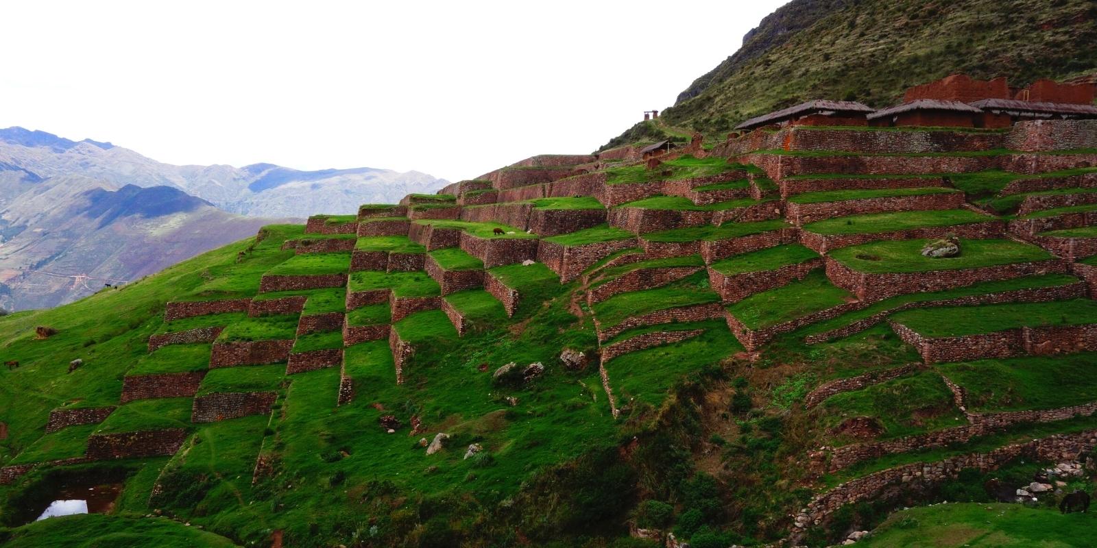
“Type 2” platforms: approximately horizontal profile platforms with vertical retaining walls, with and without irrigation.
Platform with an external appearance and shape similar to the Type 1 platform but with a vertical retaining wall. Higher distribution, generally predominating between 2,400 (Ayacucho) to 3,600 m altitude and even higher, with and without irrigation. They are generally associated with remains of cultures from the Middle Horizon, notably Huari. Especially with the details of small square-cut underground transverse channels for the collection and distribution of drainage water, with an outlet on the face of the platform to lead it to the next platform. They generally share their basic characteristics with the Late Intermediate Period and Late pre-Inca cultures.
The characteristics of its design in the landscape include
• Less variation in its width and height compared to the Type.
• Variable height, generally higher in high sectors, up to 1.80 m.
• The width variation mostly depends on the slope of the terrain.
Platforms “Type 3”: Profile of the inclined platforms, mostly without irrigation.
Very simple and rustic compared to platforms Type 1 and 2, although more similar to Type 2 for having a simple retaining wall and a distribution at a higher altitude. Located mostly on the suni ecological floor. They are more suitable for the cultivation of potatoes and other tubers, generally in dry land. In the transverse part they have a triangular profile and the base follows the slope, which is steep at the top. However, in the lower front part the construction is that of a platform. That is, with a rustic support wall to contain an increase in the thickness of the agricultural land, the slope of this layer and erosion are reduced. Therefore, they are less effective than Types 1 and 2 in counteracting erosion and helping to retain soil moisture due to their sloping profile and lack of adequate foundations.
The characteristics of its design in the landscape are close to those of a platform but with an inclination on the slope. This on the transverse side of the platform is variable and decreases the slope that can reach up to 30%. Generally shorter laterally than the other types of platforms, the walls also follow the slope almost parallel to the contour lines.
It is probable that this type, with a decrease in slope due to a greater elevation towards the bottom, represents a transition between the terrace and the later appearance of the platform in the form of a platform. The innovation consists of the construction of a retaining wall to increase the thickness of the cultivated soil cover in its lower part, both to reduce the slope and to improve the production of crops subject to the rainfall regime. This advance would have constituted an intermediate step from the earthen farming terrace to the invention of the horizontal platform terrace, which offered sufficient control over the slope to ensure irrigation.
“Type 4” terraces of tillage (soil) without irrigation.
This group has previously been described as ‘high slope fields. From the observations of their location in the landscape, it is noted that they were also integrated into the Laymes (sectoral rotation terrain), on the steep slopes of the upper Suni and low puna zones. Slope of exposed natural soil in which tola (Lepidophyllum tola) and other shrubs clung to the ground. They are common in use in all pre-Hispanic times, mostly to grow potatoes and other tubers, as well as grains introduced from the colony in areas where there was and is demographic pressure. Its pre-Hispanic origin is very old, difficult to specify, but it is still being worked.
Its features in the landscape are mostly as part of the landscape or as an articulation of the landscape on high slopes. They appear taking a form of little lateral extension and hardly perceptible profile in the high suni and low puna floors, where they can be integrated into the old laymes.
They have no platform. Its construction is not formal. Its shape is due to the work of the farmer, that is, to the removal of the earth, with its accumulation on the slope, reinforcement and compaction.
They do not have retaining walls. The soil slope is low and lacks foundations and construction. Shrubs colonize the slope and prevent erosion.
Basic build mode. It was developed in tillage mode in hillside cultivation areas; the compaction in the lower limit produces its compaction on which the agricultural soil accumulates.
There are several physical factors that originate in its construction, favoring soil humidity and temperature that promote microbiological activity. The platforms, due to their stone retaining walls, have the ability to absorb and store the sun’s heat and radiate it at night, diverting or modifying winds and frosts, and thus protecting the crops, with greater effect on small and narrow platforms.
Proven innovations in the construction of the platforms of the Sacred Valley are pointed out, in some examples of the most sophisticated with multiple layers. Next, the differences in the use of the four basic types or groups in relation to agricultural production are indicated.
In some investigated examples of the Type 1 platform, it was noted that they used clay or clayey earth linings in three parts of the platform: a) below the platform structure; b) at the bottom of the retaining wall; and c) against the wall where it was mixed with gravel. Due to the fact of retaining water and conserving humidity in a controlled way, a microbiological activity could be promoted. This activity contributes to increasing soil fertility and thus to the development of crops, also due to the migration of C02 in the atmosphere. The influence of ‘terrace’ agriculture (here the platform) on the factors that affect the increase in temperature and the migration of C02 from the soil to the atmosphere requires further investigation.
On the platform floor, the resulting temperature rise is estimated at no less than 1UC, as is also the case on the altiplano ridges (Erickson, 1987). This stimulates faster germination, promotes higher vegetative growth and thus increased yield. In Pisac, Cuzco, this system was considered to be equivalent to 300 kg of fertilizer per hectare annually.
With regard to the extensive use of gravel and stone fill at the base of Type 1 platforms, at least the concept of stone fill is also used in the platforms of the other types, but in a more limited way and generally where large stones and medians are accumulated just behind the retaining wall.
In the case of the Incas, in addition to reinforcing the base of the retaining wall and contributing to good drainage, it is suggested that they may have also served to save the amount of earth necessary to fill the platforms, by reducing the weight of the moist earth behind foundations and serve as filter layers for drainage. In many cases there must have been opportunities to bury an excess of useless rocks and small stones (salla), but in any case the soil layer is more stable, it has the advantage of better drainage when it is based on a fill of stones, gravel (gravel) and sand.
When the soil profile is deep and of medium to fine texture, an excess of water endangers the wall with its hydraulic pressure. In this particular, the types of sandy and clayey soils are differentiated, because the sand offers better drainage and in this case the retaining wall depends less on the gravel and the extension of the filling of stones and gravel. Therefore, these characteristics of the use of clay and the extension of fill stones in relation to regional soils should be further investigated, under the hypothesis that the sandy terrain predisposed a better drainage compared to more clayey soils.
Late pre-Hispanic cultures, especially the Inca, chose the most appropriate characteristics of the materials available to them to build the ‘rustic’ works of agricultural infrastructure. It is also worth considering the solutions adopted for the transport, distribution, retention and drainage of water. The evidence of the selected materials and the engineering and technology used in their use can be rescued to improve current rehabilitation and maintenance practices and take them into account in the construction of new platforms. Some of the technical knowledge of the Incas applicable to agricultural infrastructure works and as a basis for appreciating the foundations of traditional technology will then be demonstrated.
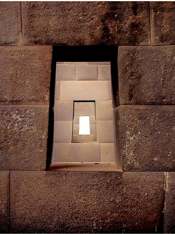
Inca architecture amply demonstrates the knowledge of the geological and constructive characteristics and qualities for the use of stones in constructions, less appreciable knowledge in Huari architecture. In the irrigation and platform infrastructure, the Incas were the ones who most used the assembly technique to ensure the straight corners of the walls, alternating the moorings of the stones. The ties, long stones that passed from one side of the wall to the other, were used with the purpose of securing the union of the wall and preventing one of its faces from falling.
In the case of platforms, the concept of tying to unite two surfaces was also used since earlier times by simply wetting the mud, for example in the Middle Horizon, to unite the face of a stone retaining wall with the moist earth in order to ensure the junction of the vertical wall to the platform.
In structuring the best architectural walls the Incas chose combinations of masonry styles and functional strength properties. They were worked to counteract the unstable ground to such an extent that the separation of the joints was avoided. In all the constructions, as they gained height, the weight and size of the stones decreased, which is evident both in the buildings and in the high retaining walls of the agricultural infrastructure.
The materials of the traditional technology for the construction of canals used in the mountains in pre-Hispanic irrigation projects, and identified in archaeological investigations, generally consist of stones selected for their smooth or coarse qualities depending on their use, settled with clayey mud mortar. and a lining of viscous clay (5 cm thick) under the stone base of the channel, in order to prevent filtration and take advantage of the necessary plasticity to resist seismic movements. These materials were placed on sandy bases (3 to 5 cm thick at the base below the clay). To ensure good drainage of the platform and behind the retaining walls, gravel or gravel was placed. These materials were also used in the construction of agricultural terraces, but in this case it is often appropriate to lay the stones of the retaining wall without mortar, because over time the voids are filled. The use of other materials, such as the juice of the giant cactus (Trichocereus pachanoi) mixed with clay, is difficult to verify in the field, except in the current practice of master builders. The ‘gigantón’ is highly appreciated by these masters because it prevents dryness and prevents cracks when mixed with clay. On the other hand, in an Inca canal excavated in Cuzco, the use of llama fat was verified to seal the interstices.
In the case of agricultural infrastructure, generally the crucial factor for its construction, its longevity and most important appearance, was the size and shape of the stones most available in situ for the pirca or the incorporation of large stones. Boulders, river pebbles and other readily available stone materials were also often used, such as from a nearby quarry, where stones were selected with the properties they wanted for certain required features, ‘works of art’ or special details. Stones selected from quarries were easier to work with than those from outcrops or simply found on the ground. However, visible outcrops often defined the length of the walls and in situ monoliths could be integrated into the walls of the platforms, and into the supporting wall of the irrigation canals.
In the engineering of the platforms of the basic points, those that controlled the construction on slopes with slopes of 5-40% (or 3-20°) should be included, while the transverse and longitudinal inclinations vary between 0 and 3%, which allow water management with little sediment transport.
The use of large stones, especially those of a somewhat rectangular shape at the top of retaining walls, today could be limited by their weight or in relation to local human capacity. Also the priority is to use them at the bottom of the wall. It is noted that in authentic walls only small stones are available when the height of the platform is relatively low. Neither small nor round stones are stable for high walls and if not enough suitable stones are found in the area this could be a limiting factor.
The depth of the strata on the platform of the platform depends on the height of the wall and the topsoil of the selected crop (for example 1 m in the case of corn). The earth used to fill the platform was almost always the same as the soil of the slope or bottom of the valley. The other materials, such as sandy soil, clay and stones, are still available where they were.
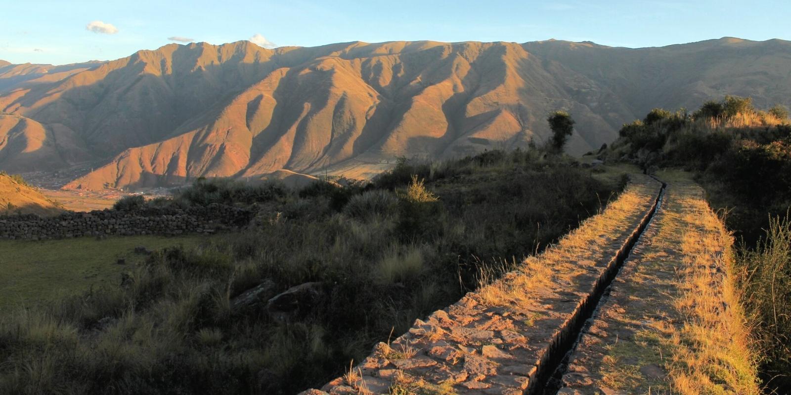
Under diverse conditions, different designs were used in the mountains to solve engineering aspects of the canals. In the main channels, the aim was to follow the contour of the landscape with a minimum slope
The gradient of the falls varied in slopes up to 61% to almost vertical, being especially high in the secondary sections that descended to approach the platforms to supply them. To choose the terrain of a route, in sites with a steep slope, the ideal was to take advantage of a geological outcrop as a stable base, thus avoiding the erosion of the channel. In the abrupt falls, the speed of the water was controlled using deflector stones, steps, textures, angles and changes of direction; fountains or dissipation wells were also used.
The hydraulic dimensions of the channels with their intakes and overflows in the mountains depend on the available water and their width also varied to control the flow and discharge according to the slope. Its minimum dimensions were between 20 and 60 cm wide and deep. There are also wider Inca and Huari channels. At Tenería, Yucay (Department of Cuzco), on an Inca property the main canal is 1.5 m between substantial walls.
But one of the widest canals in the sierra, apart from river channels, would be the Inca canal that comes out of the Huancané river, which is a maximum of 2-2.70 m wide by 1.20 m deep for water transport and includes three impressive aqueducts that allow the passage of small tributaries to carry water 20 km to Soras in the Chicha-Soras valley.
In Cuzco, from 1100 A.D., the inhabitants learned about the appropriate use of the characteristics of the stones and of making channels with supporting walls. Generally, they selected the slate slabs to achieve a smooth base that allowed the passage of water through a minimum slope, and when the gradient was more pronounced, rough stones were used to reduce the flow and, over time, Inca engineering works of greater sophistication. In the intakes and overflows, the water was controlled with stones, champas (grass) and earth. Immediately, falls or secondary channels carried the water to the platforms, where they continued the direction of the accesses for the corresponding distribution.
Canals were also built to conduct irrigation water and rain runoff vertically next to the stairway accesses between sectors to distribute the water to the platforms. Lateral intakes carried the water over the same platform through a channel attached to the wall, and the entire platform was irrigated through melgas or furrows.
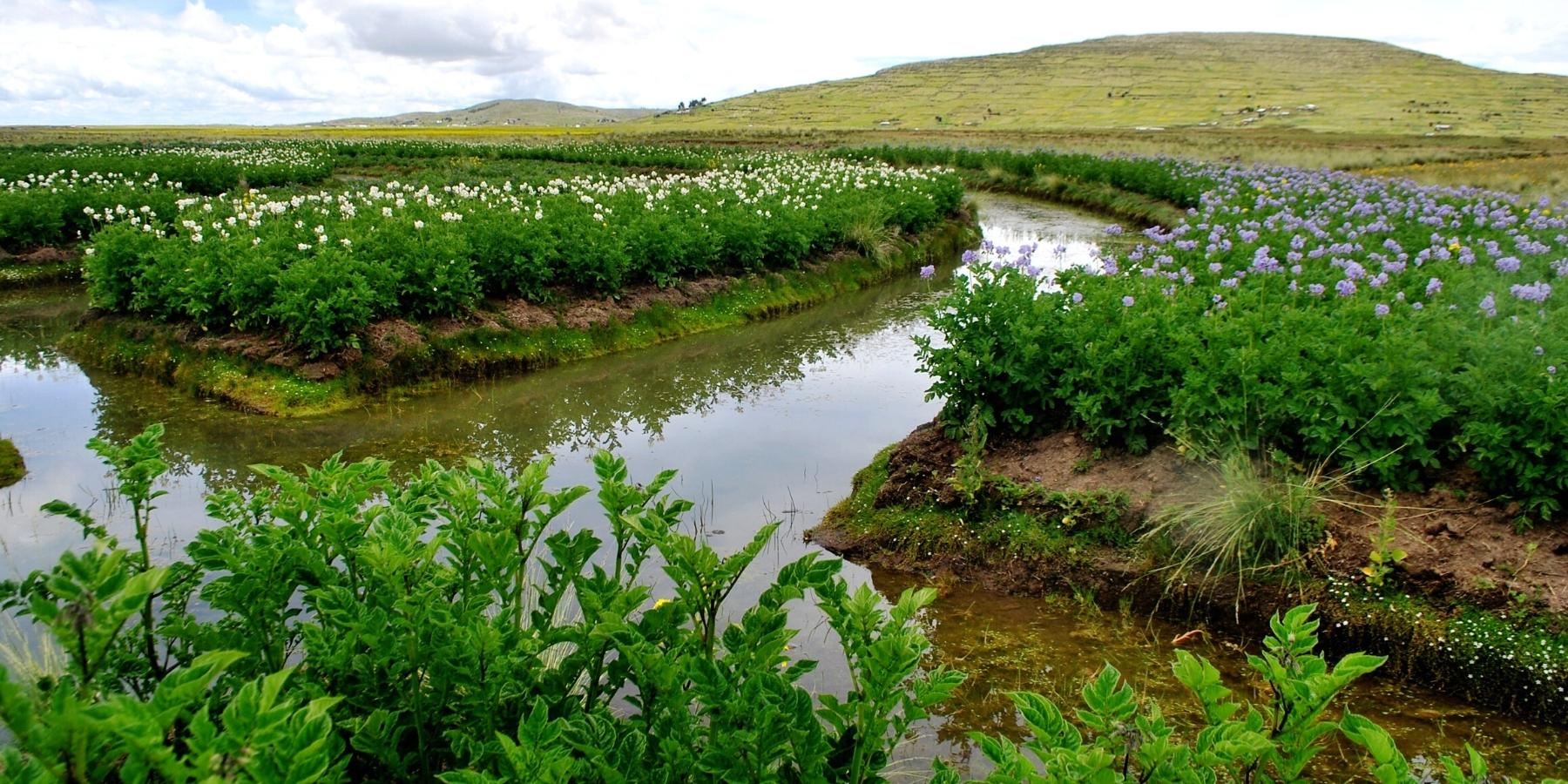
They were artificial land built on the shores of Lake Titicaca. They were mounds of earth that allowed the storage and better use of water in places of frequent flooding due to the rains. They used a series of agricultural techniques in the ridges, among them, the drawing of artificial furrows to protect the plants, facilitate drainage during rains, floods, irrigation, as sources of fertilizer and, especially, to reduce the harsh night cold. in the heights.
The Waru Waru, are ancestral practices commonly used in the highlands, in flooded or flooded areas, which consist of “pulling” earth forming a platform or “bed” surrounded by water, where planting is carried out. This water around the waru waru creates a microclimate that mitigates the effect of frost, allowing the development of crops.
The water in the canals absorbs the sun’s heat during the day and radiates it back at night, helping to protect crops against frost. The more fields cultivated in this way, the greater the effect on the environment.
The platforms are generally 4 to 10 meters wide, 10 to 100 meters long and 0.5 to 1 meter high, built with earth excavated from channels of similar size and depth. Sediments in the channels, with nitrogen-rich algae and plant and animal debris, provide fertilizer for crops.
That is to say, that our “extraordinary” effort, with all the current science and technology, we used more than 100 Massey Ferguson tractors of great horsepower, was not even close to 5% of what this imposing place represented for our ancestors from Puno.
Agriculture in the highlands of Bolivia and Peru faces very severe climatic conditions. Located at more than 3800 m above sea level, this region is characterized by frequent droughts, frosts and hailstorms during the course of crop growth, from October to April. The native populations, however, were able to develop a prosperous agriculture thanks to specific techniques adapted to local conditions (such as terraces), in addition to vertical control of a maximum of ecological floors and the use of crop biodiversity. Andean.
The ridges were and still are used for traditional crops: tubers such as potatoes, oca (Oxalis tuberosa) and grains such as quinoa (Chenopodium quinoa) and cañihua (Chenopodium pallidicaule). Several authors propose a classification based on the morphology of the ridges: checkerboard (bundles of furrows at right angles to the adjacent ones), dammed pattern (groups of ridges surrounded by low dams), linear pattern (long ridges parallel to each other), ladder pattern (with platforms in elongated figures in the form of stairs), combed pattern (the ridges converge to blind the interspersed furrows giving the impression of a hairpin or comb). It is also worth noting in this classification a particular farming system that is similar to ridges: the lagoon or qocha farming system. It is essentially found in the highlands of southern Peru, in the department of Puno: they are cultivated areas in the form of depressions that store rainwater and dry up in winter. They have two basic designs, circular or rectangular, and the water is managed by a drainage channel.
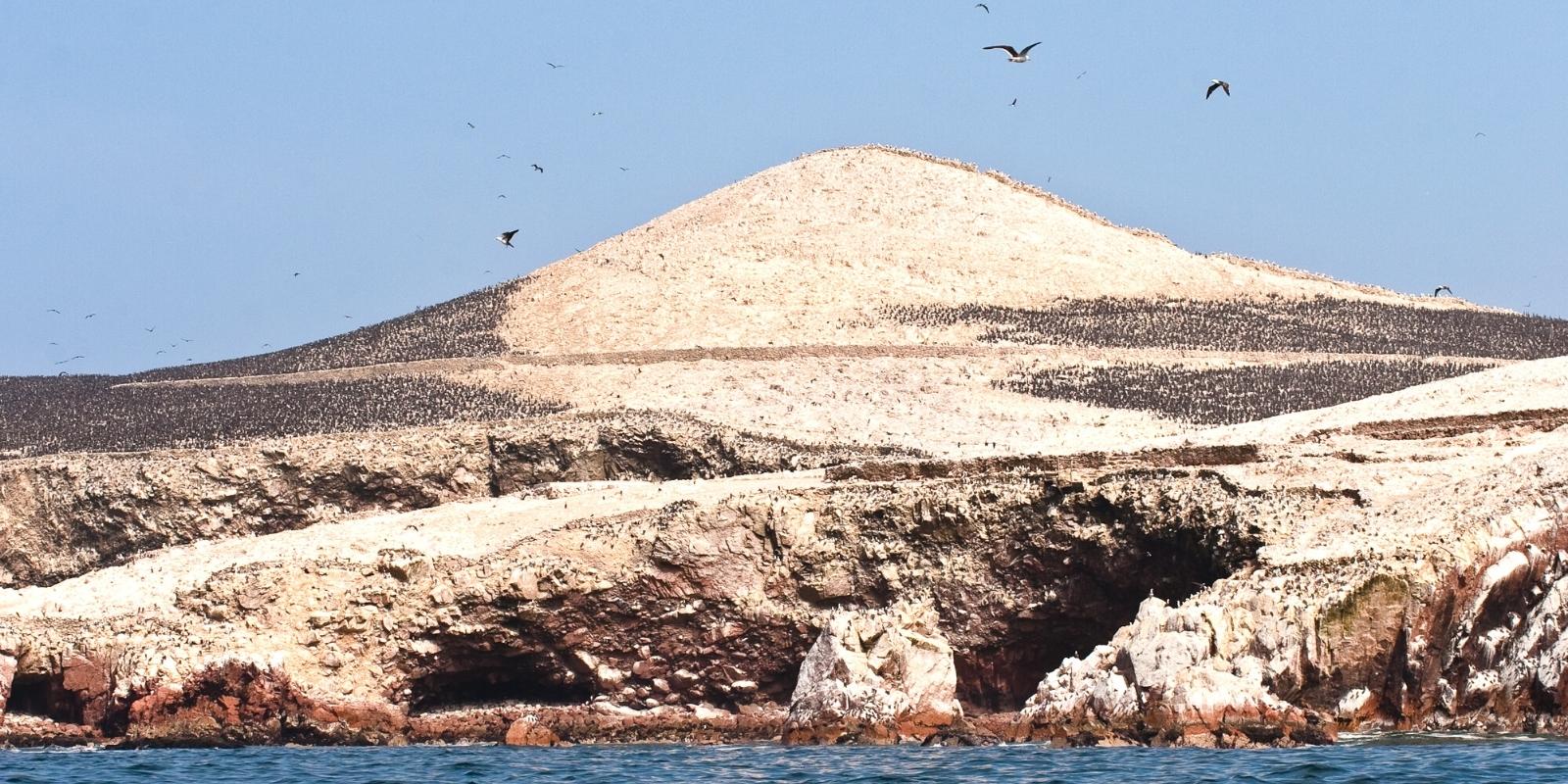
In South America, guano (derived from the Quechua word huanu meaning manure) was not only used for centuries to meet agricultural needs in coastal fields, but was also transported to the Andean mountains in caravans of llamas. The Andean civilizations used all animal droppings as manure, but seabird guano was especially valued due to its highly effective fertilizing power and as an important contributor of nitrogen to agricultural production.
The importance of guano for the subsistence of different South American civilizations during the last 4000 years, that is, from the Archaic period (c. 2300 BC) to the Late Intermediate period (1476 AD), was confirmed by the identification of extremely high concentrations of the stable isotope δ 15 N (+17.8 to +33.1 ‰) in dental calculus of human skeletons from coastal and valley archaeological sites.
Wari and Tiwanaku (300-1150 CE) and Chimor (850-1470 CE) were the largest civilizations that preceded the Incas, with empires stretching more than 1,000 km along the South American Pacific coast. These civilizations developed and survived thanks to agriculture, technology and the transfer of knowledge from their predecessors. Continued progress in the development of agriculture and technology eventually led to the rise of the Inca Empire, which flourished between c. 1400 and 1533 CE.
The Inca Empire extended throughout c. 4000 km, from near the current border between Colombia and Ecuador south through the highlands and coastal plains of Peru, part of Bolivia, to the extreme northwest of Argentina and the Maule River in central Chile. This vast empire comprised a population of between 8 and 10 million people divided into a multitude of tribal groups, each with their own customs and language.
State expansion is often motivated by economic prosperity. During the Inca Era, access to agricultural land and valuable resources such as guano, as well as access to trade routes, were key factors in the expansion of the state. As a consequence, the arid coastal desert of present-day Peru and Chile became fertile thanks to irrigation and the use of seabird guano as fertilizer, which became a highly valuable resource.
As a consequence, high levels of food security, based on 3–7 year food surpluses, were achieved through the use of innovative irrigation methods and the practice of guano fertilization. There were massive accumulations of seabird guano on several islands in the Chincha and Ballestas valleys under the control of Chincha society and within reach of their boats. The Incas collected substantial volumes of seabird guano from nearby islands such as the Chincha Islands 21 km off the southwestern coast of Peru, for use in their vast empire. Guano was even transported by trails to higher altitudes such as Machu Picchu, a distance of more than 600 km from the coast.
The Chincha was strategically important in the commercial relations of the Inca due to its guano and guano administrators. Chincha’s interactive network stretched from the Titicaca Plateau (Peru and Bolivia) to the Bay of Manta (Ecuador). In the end, however, the Incas conquered the territory of Chincha. This was possibly forcibly peaceful, most likely due to the Incas’ recognition of a valuable resource that could only be obtained by Chinca sailors capable of building and maneuvering boats in the cold and difficult coastal waters of the Pacific, all that was sown it was fertilized with seabird guano, and this was also used in many coastal valleys. The supply came from the so-called guano islands which were therefore critical to the survival and prosperity of the resident sequential civilizations.
Agriculture was the most important economic activity of the Incas. The majority of the empire’s population were farmers and large areas of terraces and associated irrigation systems were built for agricultural purposes. On such agricultural terraces, up to three crops per year could be obtained. The most important crops were corn, potatoes, quinoa, Andean amaranth, oca, ulluco, mashua and achira.
At that time, a greater extension of land was cultivated in contrast to what happened in the post-Inca occupation. The Incas built on the agriculture, technology, and knowledge of their predecessors, but expanded this on a scale never before achieved. Such agricultural productivity in the arid areas of most of the Inca territory could only be sustained with the use of fertilizers. The extension of the Inca Empire was, therefore, conditioned by the distance to seabird guano resources and, consequently, to the natural distribution of guano birds. The importance of guano for the Inca Empire led to the protection and management of guano birds and the main islands near the coast where they breed.