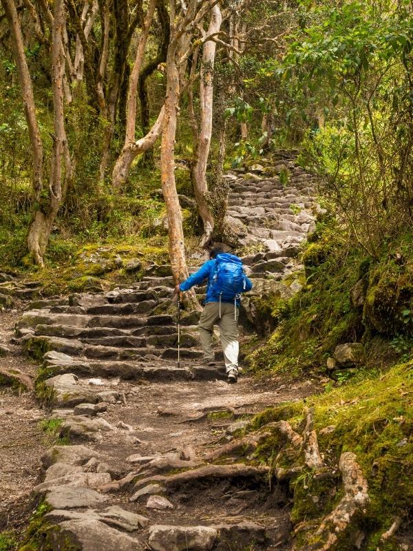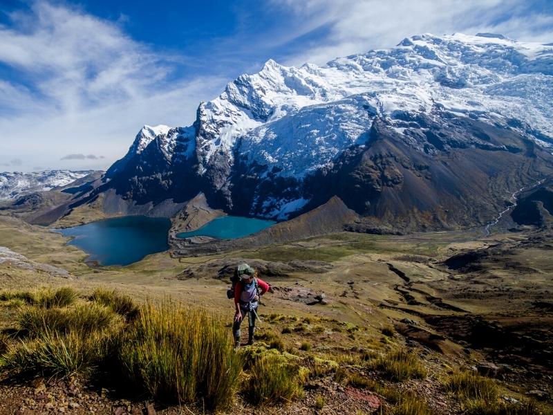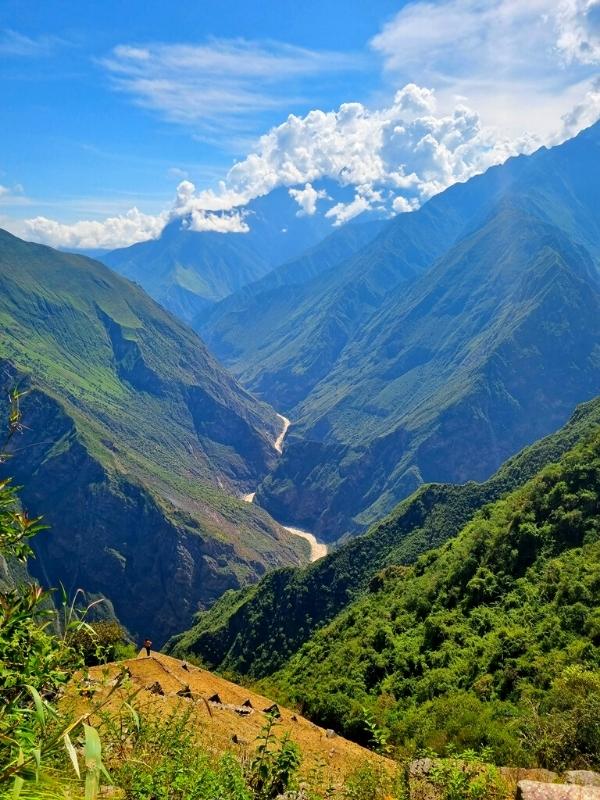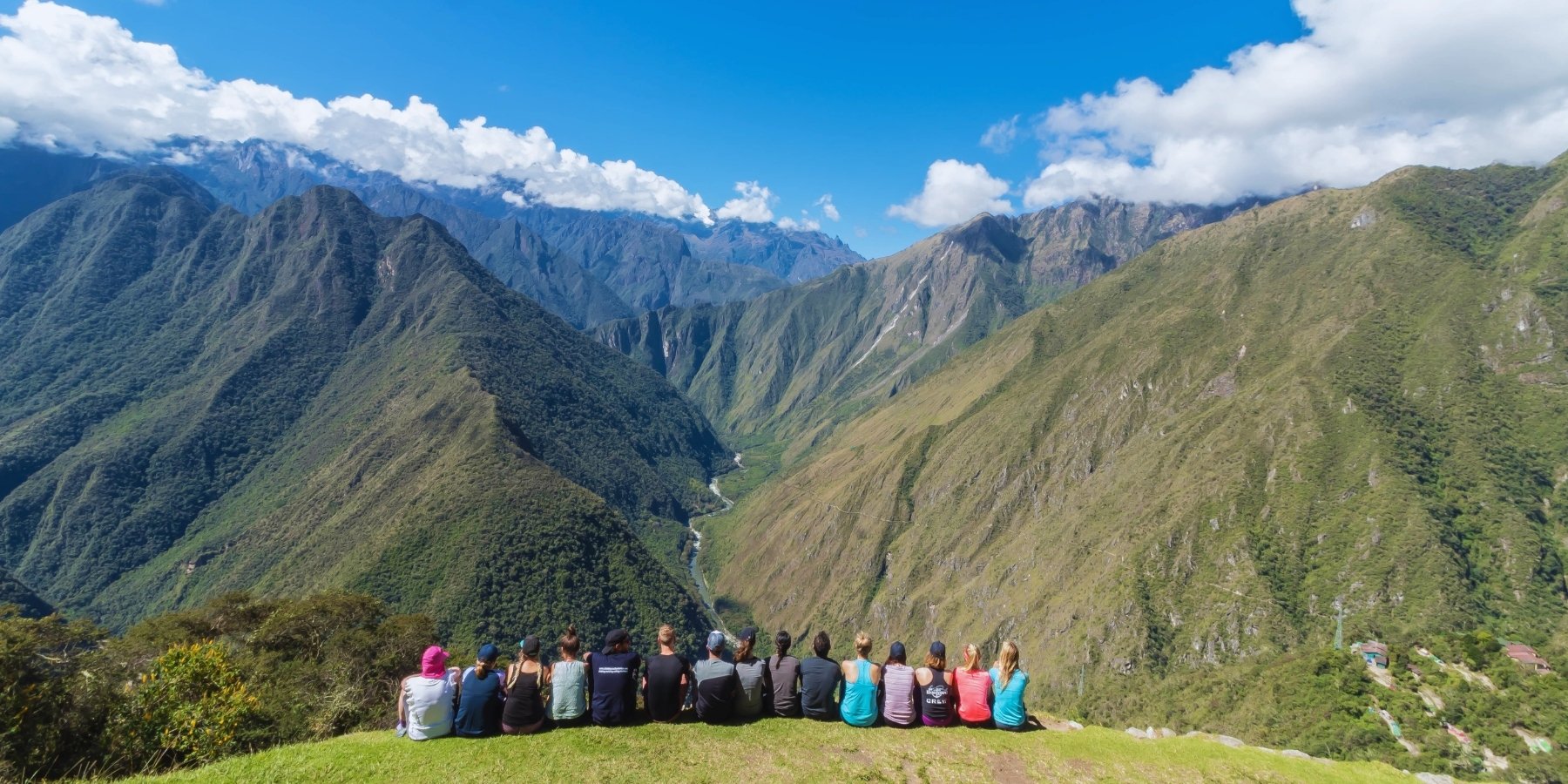
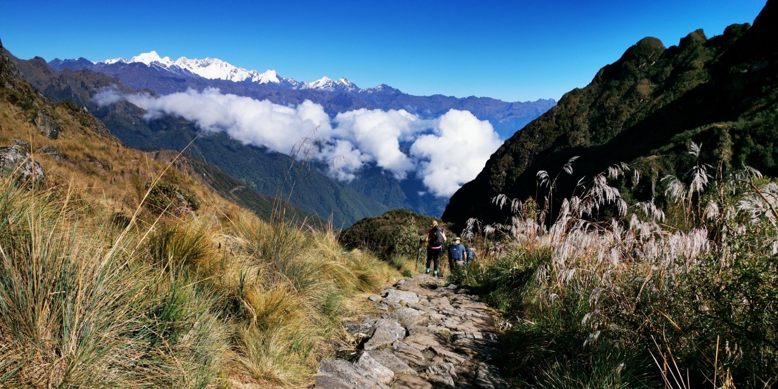
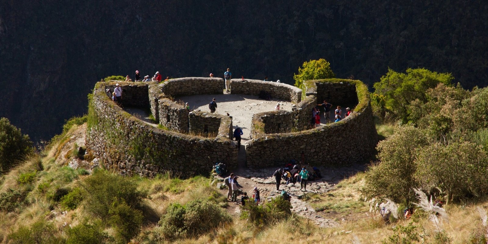
The third day of the Inca Trail to Machu Picchu is one of the most beautiful and fascinating of the entire trek, combining physical challenges with a deep immersion in history and nature. The day begins early, with a hike that ascends along cobblestone paths and Inca stairways, surrounded by lush vegetation. The first major milestone of the day is reaching the Runkurakay Pass, located at almost 4,000 meters above sea level, where a circular structure that served as a lookout and rest post for ancient travelers stands. From there, the panoramic views of the valleys and mountains are simply spectacular.
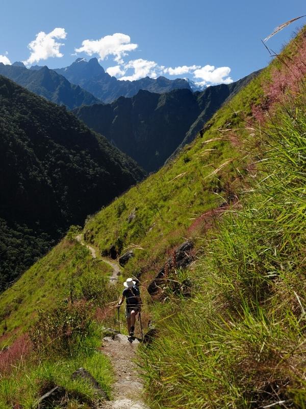
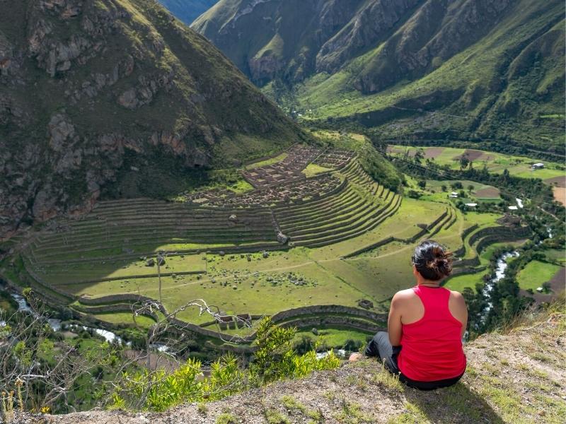
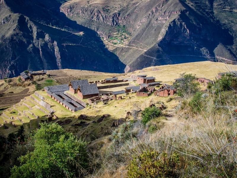
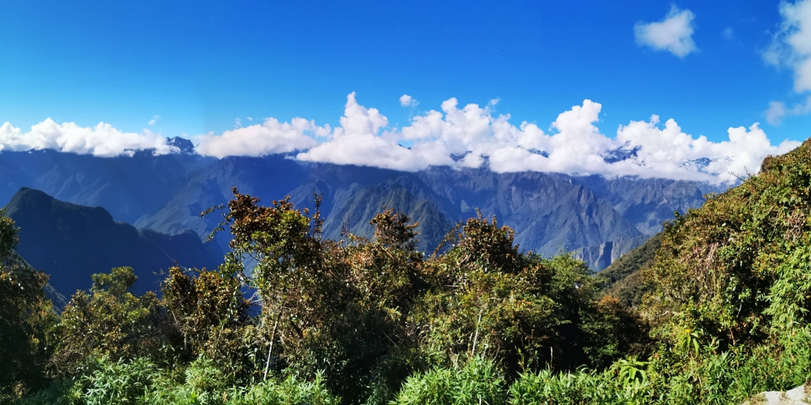
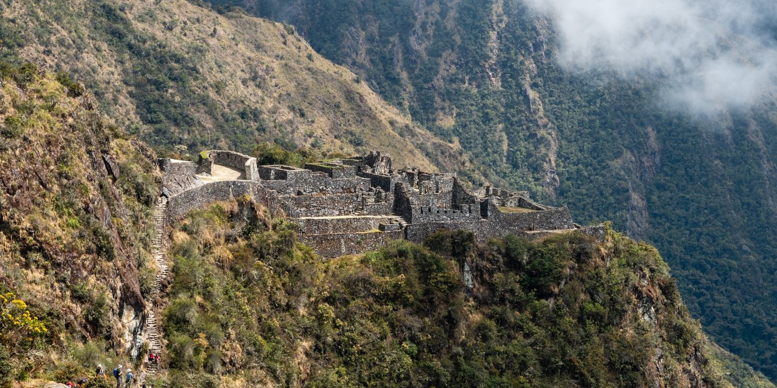
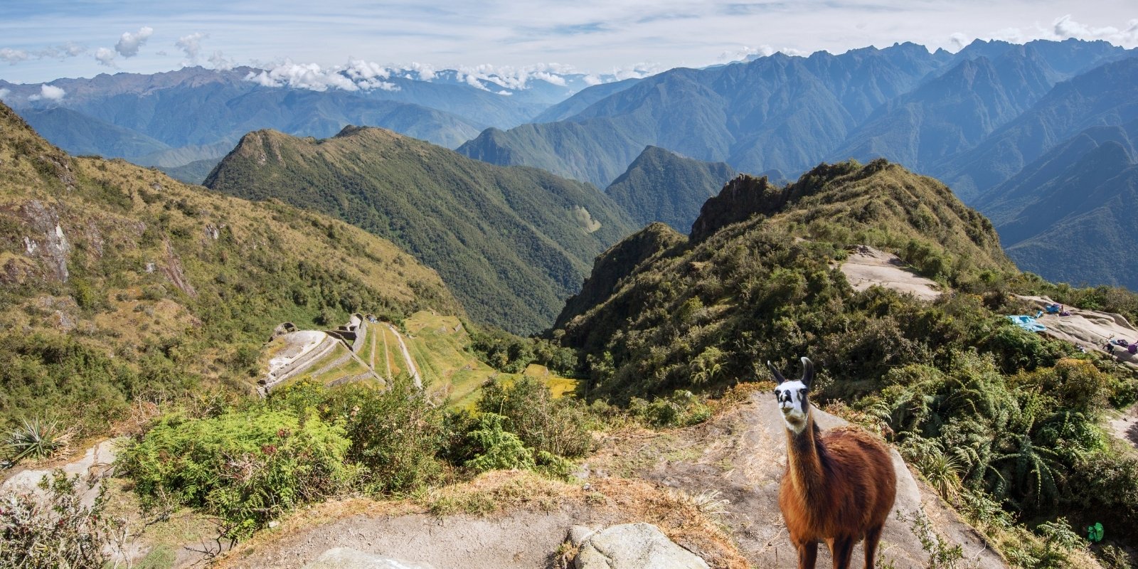
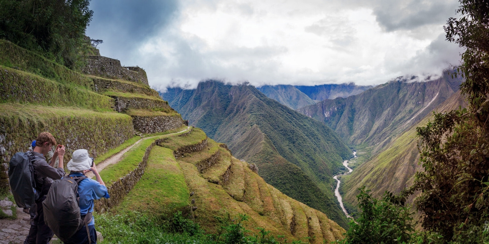
After Runkurakay, the trail descends to impressive ruins such as Sayacmarca, an archaeological complex strategically located on a hilltop, and Phuyupatamarca, known as “the city above the clouds” for its elevated position and the frequent mists that surround it. These sites, with their terraces, stairways, and ceremonial structures, offer a window into the past and allow us to imagine life during the Inca Empire. The Inca Trail to Machu Picchu continues through a cloud forest, where the humidity and dense vegetation create a magical, vibrant environment.
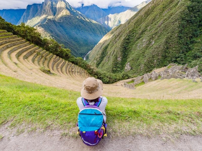
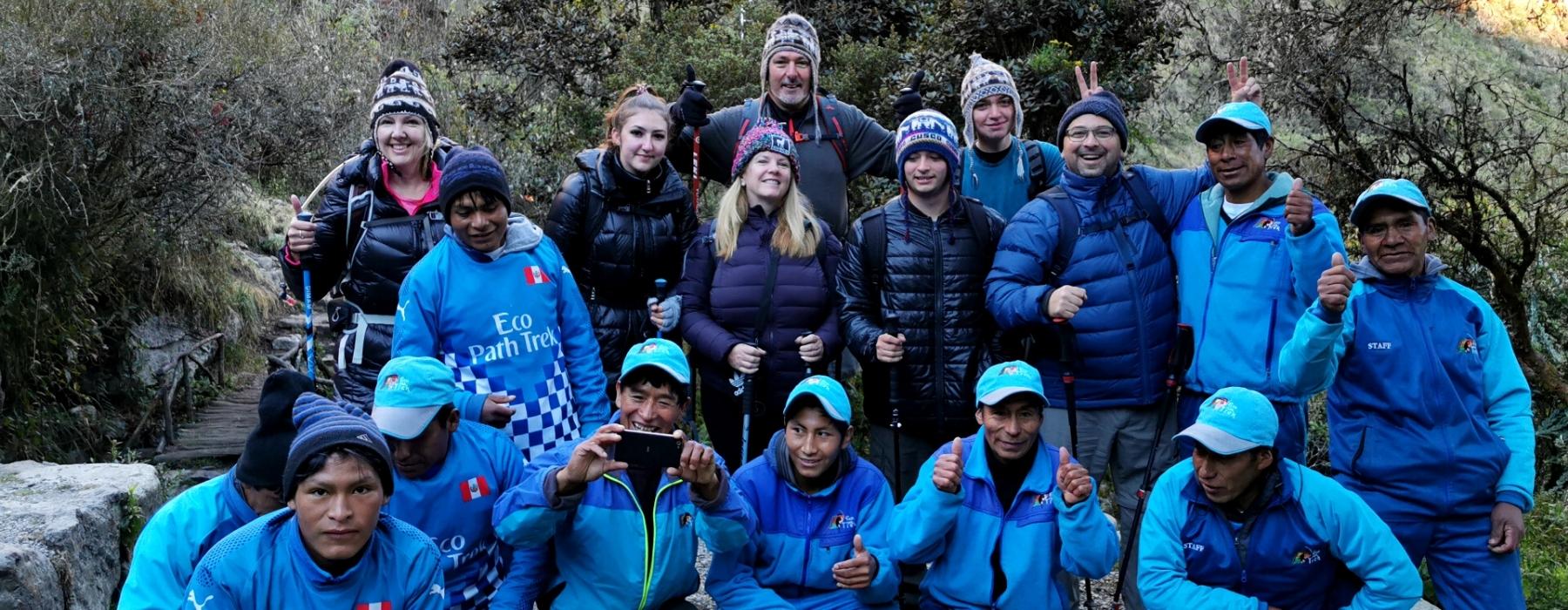
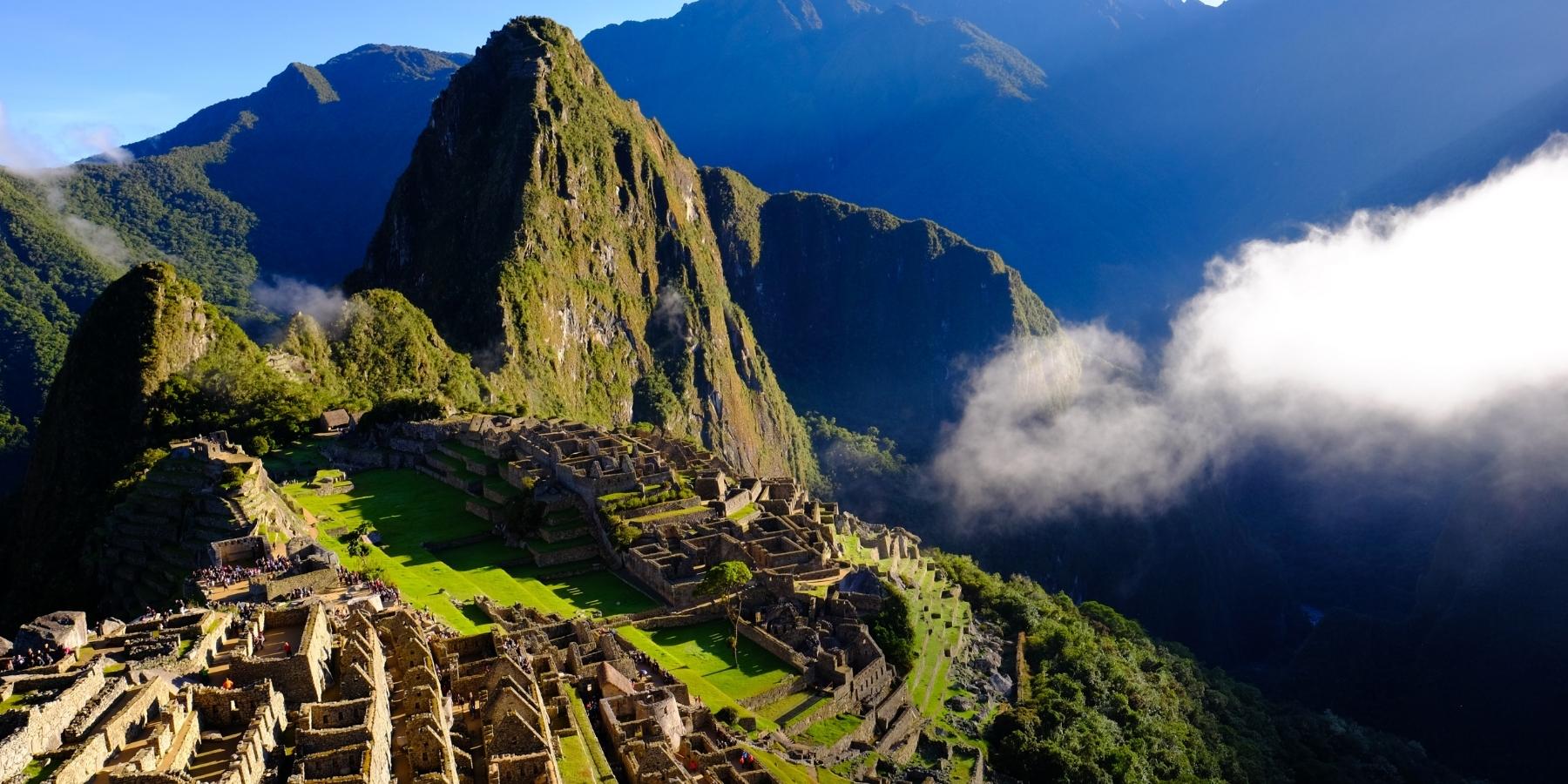
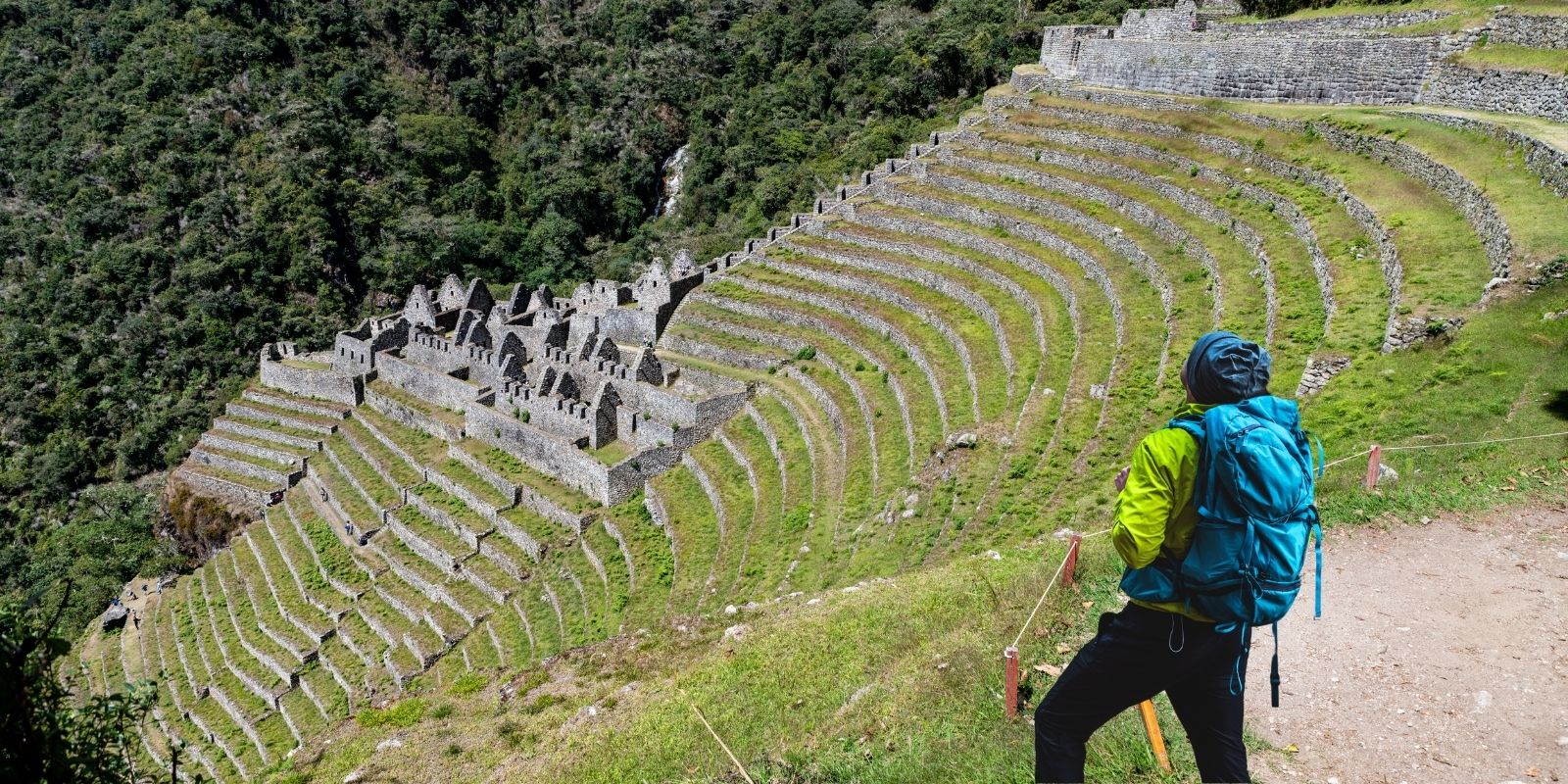
The day culminates at the Wiñay Wayna campsite, one of the most iconic sites on the Inca Trail to Machu Picchu. Here, the agricultural terraces and Inca ruins blend harmoniously with the landscape, offering a perfect setting for resting and reflecting on the experience. Wiñay Wayna, which means “forever young” in Quechua, is also a place of great spiritual energy, ideal for preparing emotionally for the arrival at Machu Picchu the following day. The third day is, without a doubt, a blend of physical exertion, natural beauty, and a connection with the Inca legacy that leaves an indelible mark on hikers.
The third day of the Inca Trail to Machu Picchu is one of the most intense and spectacular of the trek, combining physical challenges with a deep immersion in nature and Inca history. Below is a typical itinerary for this day:
Time: Between 5:00 and 6:00 a.m.
Activity: The day begins early with a wake-up call at the Pacaymayo camp (or similar, depending on the group). After a hearty breakfast, hikers prepare for the most demanding day of the trek.
Distance: Approximately 5 km (3.1 miles).
Duration: 2–3 hours.
Elevation: From 3,500 meters (11,482 feet) at Pacaymayo to 3,980 meters (13,057 feet) at Runkurakay Pass.
Description:
The hike begins with a steep ascent along cobblestone paths and Inca stairways. The landscape includes cloud forests, gorges, and stunning views of the Andean valleys. Along the way, you pass the Runkurakay archaeological site, a circular structure that served as a lookout and rest post for the Incas.
Distance: Approximately 3 km (1.9 miles).
Duration: 1–2 hours.
Elevation: From 3,980 meters (13,057 feet) at Runkurakay to 3,600 meters (11,811 feet) at Sayacmarca.
Description: After the Runkurakay pass, the trail descends to Sayacmarca, a hilltop archaeological complex. Sayacmarca, which means “inaccessible village,” is an impressive site with terraces, stairways, and ceremonial structures. Here, guides usually offer a detailed explanation of the site’s history and function.
Distance: Approximately 5 km (3.1 miles).
Duration: 2–3 hours.
Elevation: From 3,600 meters (11,811 feet) in Sayacmarca to 3,680 meters (12,073 feet) in Phuyupatamarca.
Description:
The trail continues through a cloud forest, with dense vegetation and frequent mist. You reach Phuyupatamarca, known as “the city above the clouds,” an archaeological site with terraces, ceremonial baths, and panoramic views of the Andes. This is an ideal place to rest, have lunch, and enjoy the scenery.
Distance: Approximately 6 km (3.7 miles).
Duration: 2–3 hours.
Elevation: From 3,680 meters (12,073 feet) in Phuyupatamarca to 2,650 meters (8,694 feet) in Wiñay Wayna.
Description:
The descent is steep and requires caution, as the trail is composed of Inca steps and narrow paths. You pass minor archaeological sites and enjoy the transition from the cloud forest to a more tropical environment. The day culminates at the Wiñay Wayna campsite, one of the most iconic sites on the Inca Trail.
Activities:
Wiñay Wayna, which means “forever young” in Quechua, is an impressive archaeological complex with agricultural terraces, water sources, and ceremonial structures. Hikers have time to explore the site and learn about its historical significance. After dinner, the group prepares for the last day of trekking, which will culminate with the arrival at Machu Picchu.
Day Three Summary
Total distance: Approximately 15 km (9.3 miles).
Duration: 8–10 hours of hiking.
Elevation gain: Steep ascent and descent, with a peak elevation of 3,980 meters (13,057 feet) at Runkurakay.
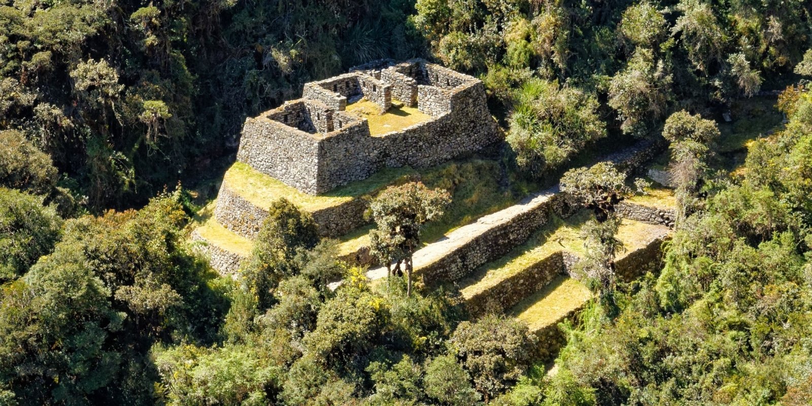
The ruins of Runkurakay are a fascinating Inca archaeological site located on the Inca Trail to Machu Picchu, at an altitude of approximately 3,980 meters (13,057 feet). This circular complex, whose name in Quechua means “sunken basket,” served as a tambo, or rest and lookout post, for travelers and messengers (chasquis) who traveled the Inca Empire’s road network. Its semicircular design, with well-preserved stone walls, blends harmoniously into the mountainside, offering panoramic views of the surrounding valleys and gorges. Runkurakay was not only a strategic location for control and logistics, but also a space with possible ceremonial use, reflecting the functional and spiritual duality characteristic of Inca architecture. Its location at one of the highest points along the trail makes it a memorable landmark for hikers, who can imagine the importance of this place in the vast network of the Qhapaq Ñan.
The ruins of Sayacmarca, whose name in Quechua means “inaccessible village,” are an impressive Inca archaeological site located high on a hill, at an altitude of approximately 3,600 meters (11,811 feet), on the Inca Trail to Machu Picchu. This strategically positioned complex offers spectacular views of the surrounding valleys and mountains, suggesting that it served both defensive and ceremonial functions. Sayacmarca is composed of agricultural terraces, stairways, plazas, and residential structures, all connected by narrow passageways and water channels that demonstrate advanced Inca engineering. This site is believed to have been an important control and rest center for travelers on the Qhapaq Ñan, as well as a sacred space dedicated to rituals and astronomical observations. Its isolated location and architectural design reflect the Inca’s ability to adapt to the terrain and create structures that harmonize with the landscape, leaving visitors awestruck by their beauty and mystery.
The archaeological complex of Conchamarka, located on the Inca Trail to Machu Picchu, near the site of Sayacmarka, is an Inca enclosure consisting of two rooms built on a stone platform. The Inca Trail runs alongside this enclosure, where visitors continued their journey to the great city of Machu Picchu. Scholars believe this space was designated as a habitation for servants, who prepared meals for the upper classes who lived in the Sayacmarka area. It also served as a storage space for food, weapons, and utensils.
The roofs of these buildings were covered with wooden beams tied together with bamboo canes, and the thatch was covered with the Andean Ichu thatch. This roof was renewed annually, as the geographical area in which it is located is an area of high humidity and heavy rainfall. The Incas cooked their food in stone and clay ovens, fueled 24 hours a day with firewood brought from the Urubamba Valley. Many of the dishes consumed during the Inca era were prepared with fresh ingredients, rich in protein, minerals, and vitamins. The Inca diet was based on corn, chili peppers, avocado, llama meat, potatoes, and beans.
Phuyupatamarca is one of the most impressive archaeological sites along the Inca Trail to Machu Picchu in Peru. Its name, derived from Quechua, translates to “Town above the Clouds” or “Place of the Clouds,” reflecting its elevated location and frequent misty atmosphere. Phuyupatamarca is situated along the Classic Inca Trail, approximately 3,600 meters (11,811 feet) above sea level, in the Cusco Region of Peru. Perched on a mountain ridge, the site offers breathtaking panoramic views of the surrounding valleys and the Urubamba River. Its high-altitude location often places it above the clouds, creating a mystical and serene atmosphere.
Phuyupatamarca was built during the height of the Inca Empire (15th century) and served as an important religious, ceremonial, and administrative center. The site was likely used for rituals, astronomical observations, and as a resting point for travelers and pilgrims on their way to Machu Picchu. As part of the extensive Inca road network (Qhapaq Ñan), Phuyupatamarca played a strategic role in connecting Machu Picchu with other Inca settlements.
Phuyupatamarca showcases classic Inca engineering and architectural techniques, adapted to the challenging mountainous terrain:
Terraces: The site features a series of agricultural terraces, which were used for cultivation and to stabilize the steep slopes.
Ritual Baths: One of the most notable features is a complex system of ceremonial fountains and baths, fed by natural springs. These baths were likely used for purification rituals.
Temples and Plazas: The ruins include remnants of temples, plazas, and residential structures, suggesting a mix of religious and administrative functions.
Stonework: The precision-cut stone walls and trapezoidal doorways are characteristic of Inca architecture, demonstrating their advanced masonry skills.
Phuyupatamarca’s location and design reflect the Inca’s deep connection to nature, astronomy, and spirituality. The site’s alignment with celestial events and its proximity to water sources highlight its ceremonial significance. The ritual baths and fountains symbolize the Inca reverence for water, which they considered a sacred element. Phuyupatamarca is a key stop for hikers on the 4-day Classic Inca Trail trek to Machu Picchu. It is typically visited on the third day of the trek. The site offers some of the most stunning views along the trail, making it a favorite spot for photography and reflection. The ceremonial baths at Phuyupatamarca are still functional, showcasing the Inca’s advanced hydraulic engineering.
The Intipata ruins are an Inca archaeological site located on the Inca Trail to Machu Picchu, in the Cusco region of Peru. This site, whose name in Quechua means “Place of the Sun” or “Terraces of the Sun,” is less well-known than other sites along the Inca Trail, but no less impressive. Intipata is located on the final stretch of the Inca Trail, about 2,840 meters above sea level, near the famous Wiñay Wayna site and a few hours’ walk from Machu Picchu.
It is only accessible to those trekking the Inca Trail, either on the classic 4-day route or other variants. It is a common stop on the third or fourth day of the trek. Intipata was built during the height of the Inca Empire (15th century) and was part of the network of sites connected by the Qhapaq Ñan (Inca Trail). Intipata is believed to have been an agricultural and ceremonial center. Its extensive terraces suggest it was used for growing food, while its strategic location and design indicate it may also have had a ritual or astronomical purpose.
As part of the Inca Trail, Intipata served as a resting and supply point for travelers and pilgrims en route to Machu Picchu. Intipata is notable for its impressive design and adaptation to the mountainous terrain. The site features a series of stepped terraces built into the mountainside. These terraces not only served as a means of cultivation but also to prevent soil erosion.
The Incas incorporated a sophisticated drainage system into the terraces to manage rainwater and prevent flooding. From Intipata, one can enjoy spectacular views of the Urubamba River Valley and the surrounding mountains, adding aesthetic and strategic value to the site. Intipata exemplifies the harmony between Inca architecture and the natural landscape. Its design makes the most of the available terrain and resources. Intipata is a fascinating stop for Inca Trail hikers. It offers a more peaceful experience and the opportunity to appreciate Inca engineering in a less crowded setting.
The name “Intipata” reflects the importance of the sun in the Inca worldview, as the sun (Inti) was one of their most important deities. Intipata’s terraces are oriented to receive maximum sunlight, suggesting advanced knowledge of agriculture and astronomy. The site is a testament to the Inca’s ability to transform difficult terrain into productive and functional areas.
The Wiñayhuayna ruins (also spelled Wiñay Wayna) are one of the most impressive and iconic archaeological sites on the Inca Trail to Machu Picchu, in the Cusco region of Peru. The name “Wiñayhuayna” comes from an orchid that grows in the area and blooms year-round, symbolizing eternal youth. It is a site that combines natural beauty, impressive architecture, and profound historical and cultural significance. Wiñayhuayna is located on the Inca Trail route, approximately 2,650 meters above sea level, on a steep mountainside overlooking the Urubamba River Valley. It is only accessible to those trekking the Inca Trail, either on the classic 4-day route or the short 2-day Inca Trail. It is a mandatory stop on the third or fourth day of the hike, just before reaching Machu Picchu. Wiñayhuayna was built during the height of the Inca Empire (15th century) and was part of the network of sites connected by the Qhapaq Ñan (Inca Trail). The site is believed to have had a dual purpose: agricultural and ceremonial. Its terraces were used for cultivation, while its religious structures suggest it was also a place of worship and rituals. Wiñayhuayna was a key point on the Inca Trail, serving as a rest and supply center for travelers and pilgrims on their way to Machu Picchu. Wiñayhuayna is an outstanding example of Inca engineering and architecture, with the following main features:
Agricultural Terraces: The site features a series of semicircular terraces built into the mountainside. These terraces not only served for cultivation but also to stabilize the soil and prevent erosion. Residential and Ceremonial Sectors: Wiñayhuayna is divided into two main sectors:
Residential Sector: Composed of stone buildings that likely housed the site’s inhabitants.
Ceremonial Sector: Includes more elaborate structures, such as temples and ritual fountains, which reflect the spiritual importance of the site.
Water Sources: The site has a system of fountains and water channels that demonstrate the Inca’s advanced hydraulic knowledge.
From Wiñayhuayna, you can enjoy spectacular views of the Urubamba River valley and the surrounding mountains. Wiñayhuayna is a perfect example of how the Incas integrated their constructions with the natural environment. The site is surrounded by lush vegetation and waterfalls, which adds to its beauty and mysticism. It is one of the highlights of the Inca Trail and a favorite spot for hikers. Many groups camp near Wiñayhuayna before reaching Machu Picchu the next day.
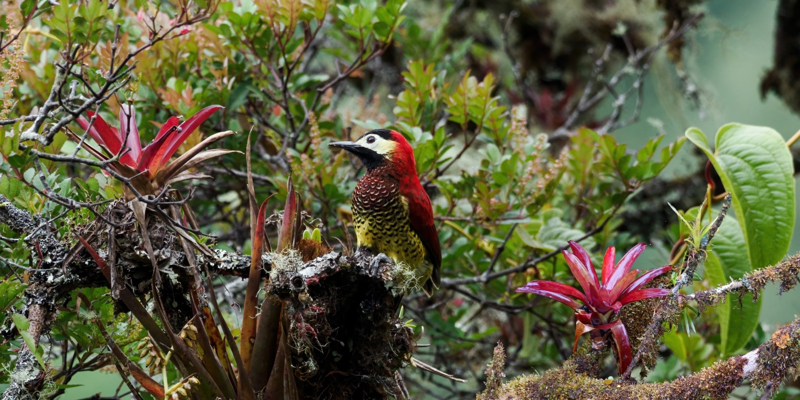
Crimson-mantled Woodpecker (Colaptes rivolii)
Commonly known as the crimson-mantled woodpecker or crimson-breasted woodpecker, it is a species of bird belonging to the Picidae family. Males have a bright crimson head, crest, and nape. The breast and belly are a deep crimson shade. The wings and back are black with white markings. Females are similar, but with a black crest and nape. The strong, straight bill, typical of woodpeckers, is adapted for boring into wood.
This species is found in humid mountain forests, especially in areas with large trees and dense vegetation. It is distributed in the Andes, from Colombia and Ecuador to Peru and Bolivia. It inhabits altitudes ranging from 1,500 to 3,500 meters above sea level. It feeds primarily on insects, larvae, and ants, which it finds by piercing the bark of trees with its beak. It also consumes fruits and berries.
It nests in hollows excavated in dead or decaying trees. The female lays two to four eggs, which are incubated by both parents. It emits loud, repetitive calls that can be heard from a distance. It is a relatively rare species and not as commonly seen as other woodpeckers. Its crimson plumage makes it one of the most striking species within its genus. This woodpecker exemplifies the diversity and beauty of the birds that inhabit the Andean forests, and its conservation is crucial to maintaining the ecological balance in these regions.
Scarlet-bellied Mountain Tanager (Anisognathus igniventris)
Commonly known as the red-breasted tanager, red-bellied tanager, or red-bellied tanager, it is a species of bird belonging to the Thraupidae (tanager) family. It is a striking and colorful species that lives in the mountain forests of the Andes. Males have a black head and throat, a deep red breast and belly, and an olive-green back and wings. They have a bright blue patch on the crown, which is more visible in males. Females are similar, but with duller, less contrasting colors. The red on the belly may be less intense. The bill is short and stout, adapted for an omnivorous diet (fruits and insects).
It lives in humid mountain forests, forest edges, and areas with dense vegetation. It prefers altitudes between 1,500 and 3,500 meters above sea level. Its diet is primarily frugivorous, consuming fruits, berries, and seeds. It also supplements its diet with insects and other small invertebrates. It usually feeds in mixed flocks with other bird species, which provides greater protection from predators. It builds cup-shaped nests in trees or bushes. The female lays two to three eggs, which are incubated by both parents. It emits a variety of calls and songs, including high-pitched and repetitive notes. Its song is melodious and distinctive.

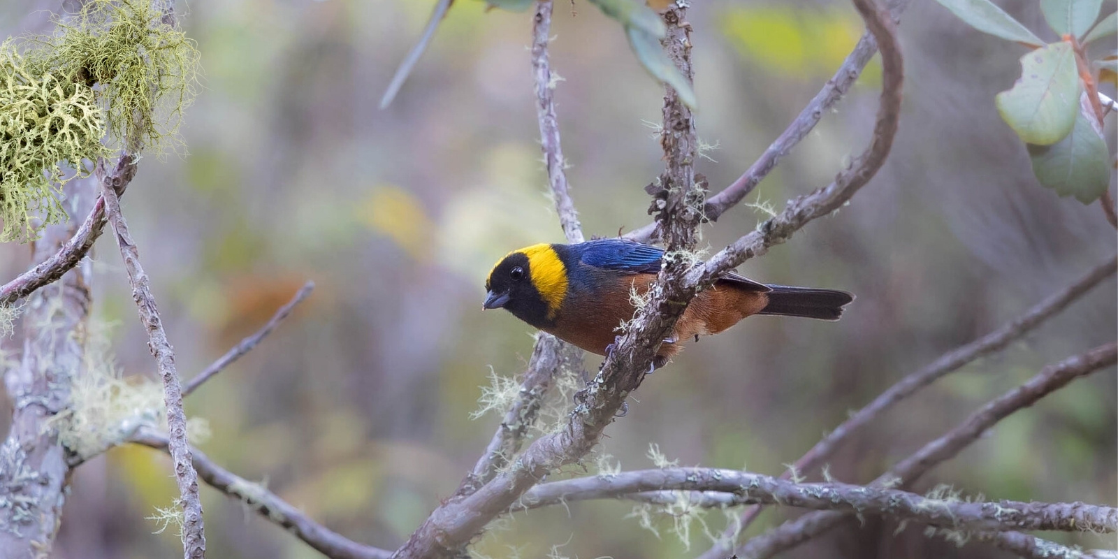
Golden-collared Tanager (Iridosornis jelskii)
Iridosornis jelskii, commonly known as the Jelski’s tanager or red-backed tanager, is a species of bird belonging to the Thraupidae (tanager) family. It is endemic to the Andes and is notable for its vibrant coloration and restricted distribution. It measures approximately 16–17 cm in length. Males have a bright blue head and throat, a deep red back, and a golden-yellow belly. The wings and tail are bluish-black. Females are similar, but with duller, less contrasting colors. It is endemic to the Andes, found in Peru. It inhabits humid montane forests and cloud forests, generally at altitudes between 2,500 and 3,500 meters above sea level. It prefers areas with dense vegetation and tall trees. Its diet is primarily frugivorous, consuming fruits, berries, and seeds. It also supplements its diet with insects and other small invertebrates. It usually feeds in mixed flocks with other bird species, which provides greater protection from predators. It builds cup-shaped nests in trees or shrubs.
The female lays two to three eggs, which are incubated by both parents. It emits soft, melodious calls, including high-pitched, repetitive notes. The name “Iridosornis” comes from Greek and means “rainbow bird,” in reference to its vibrant coloration. The name “jelskii” honors the Polish naturalist Konstanty Jelski, who made important contributions to the study of South American fauna in the 19th century. It is a rare species and difficult to observe due to its remote habitat and inconspicuous behavior. Jelski’s tanager plays an important role in seed dispersal, contributing to the regeneration of Andean forests. Its presence is an indicator of the health of these ecosystems.
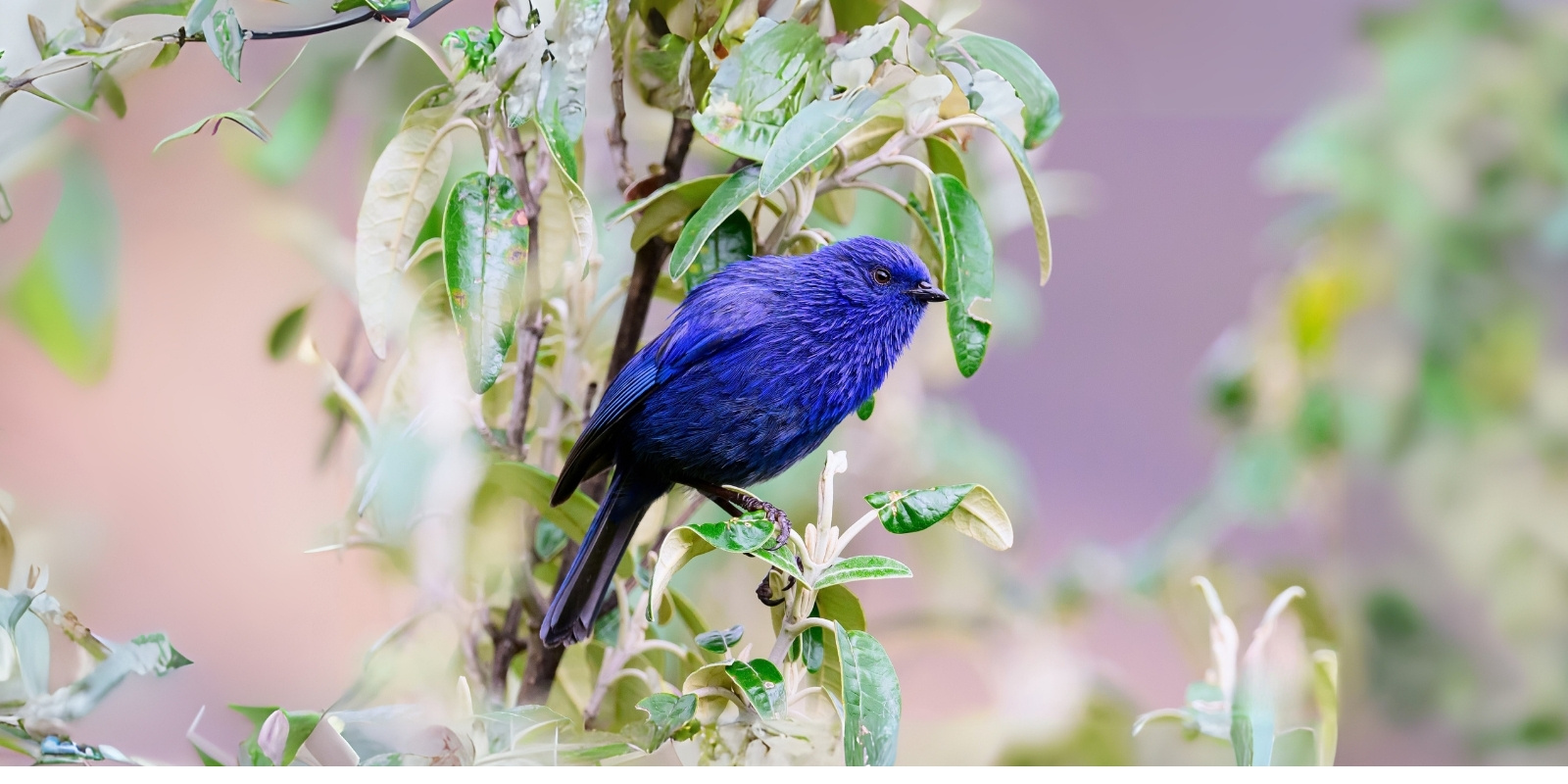
Tit-like Dacnis (Xenodacnis parina)
Commonly known as the Blue Dacnis, it is a species of bird belonging to the Thraupidae family. It is endemic to the Andes of South America and is found in regions of Peru. It is a small bird, approximately 10 to 12 cm long. Males have bright blue plumage, while females are duller, with predominantly gray and brown colors. It has a short, pointed beak, adapted to feed on nectar and small insects. It is found in scrubland and montane forests, generally between 2,500 and 4,000 meters above sea level.
It prefers areas with dense, moist vegetation, such as forest edges and shrubby areas. Its diet consists primarily of nectar, although it also consumes small insects and spiders. It is an active bird that moves quickly through the vegetation in search of food. It is a little-studied species, so relatively little is known about its behavior and ecology. Its scientific name, Xenodacnis, comes from the Greek and means “strange dacnis,” referring to its resemblance to other birds of the Dacnis genus, but with distinctive characteristics.